Tool Use

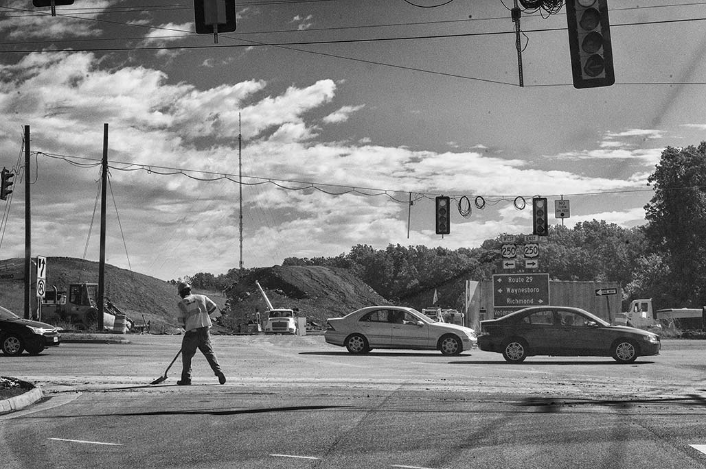
At this point the driver has failed to see several signs regarding street usage. Tell them, tell them again, tell them again

Zoning is a tool that legislators use to direct the day to day life in their territory. Zoning can be a glass of water for a thirsty person or club against the head of an enemy.
For 40+ years, neighbors have corresponded with legislators and folk in Government about Woolen Mills zoning. This year, an advisory board member responded (thank you Lyle) but otherwise, no member of the City Council, of the deciders, has chosen to engage us in conversation.

In 2000, for the Comprehensive Plan, NDS came to the neighborhood and requested input. It was a different era.

This post is a cursory examination of zoning when used without the consideration of The People whose neighborhood will be shaped by the zoning. We are interested in why zoning practice is repeatedly bad zoning practice. We interact and interact and little changes.

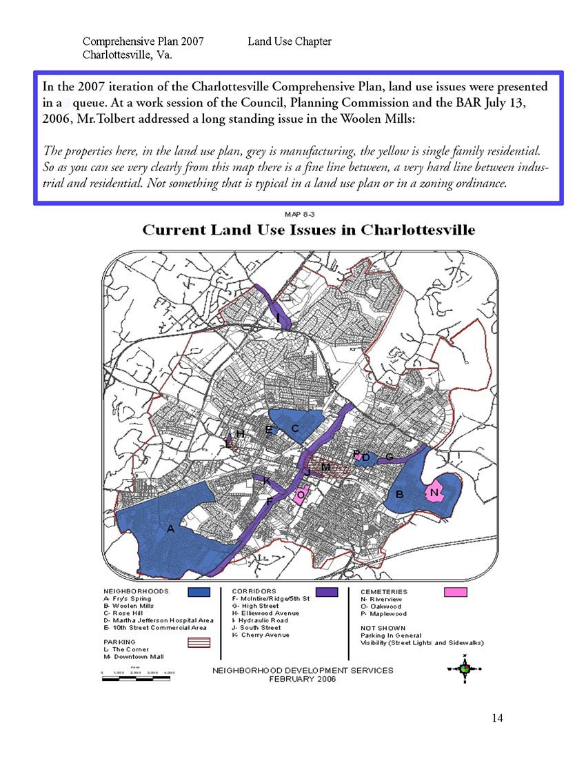
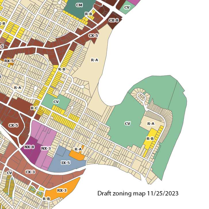
Mr.Tolbert on the “very hard line between industrial and residential.” Now the hard line is between IX-5, NX-3 and residential. Carrying forward the vision of Council from 1957.

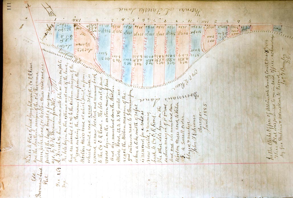
South of Market Street/Woolen Mills Road subdivision plat

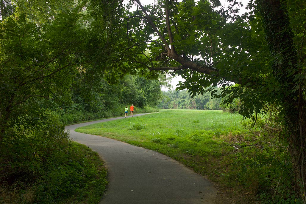
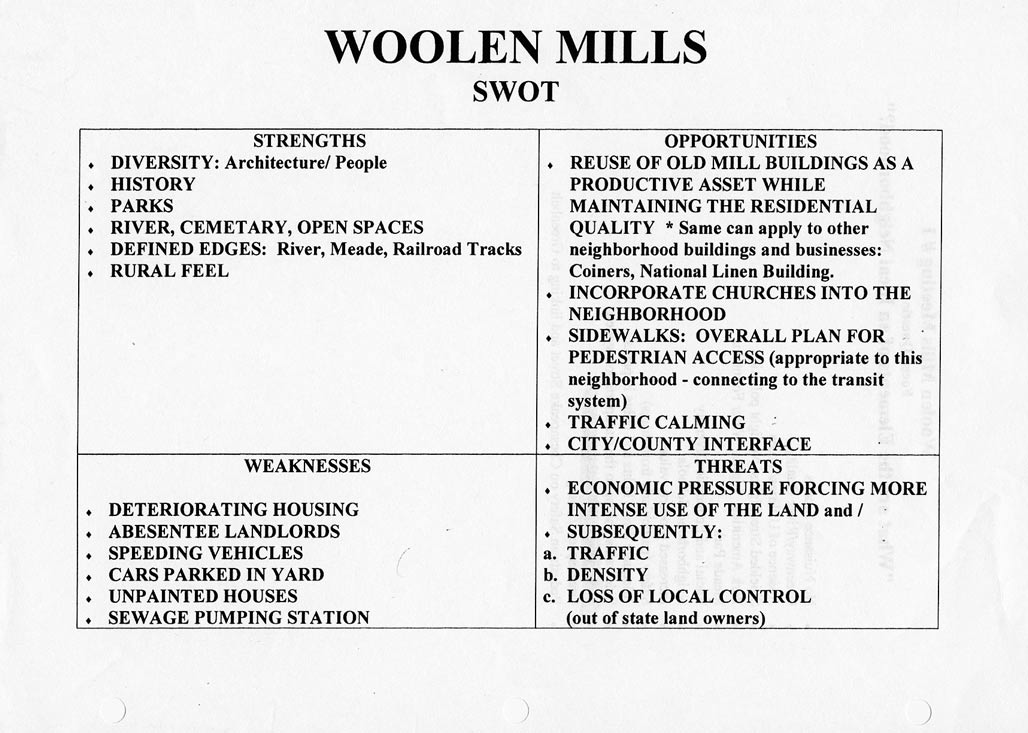
A neighborhood is a living thing composed of topography, culture, people, plants, pathways, businesses, animals and architecture. Neighborhoods require planning and care. It has been So Discouraging trying to obtain planning and care from our City. Neighborhoods are sensitive.
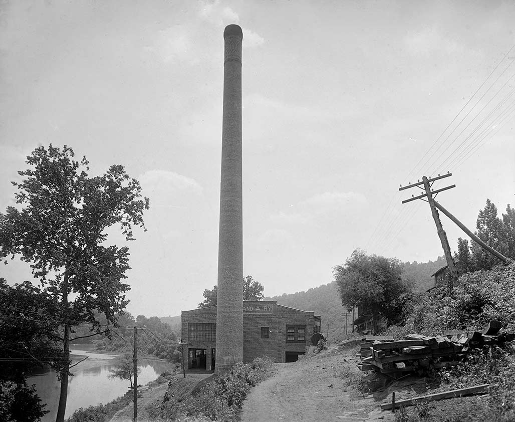
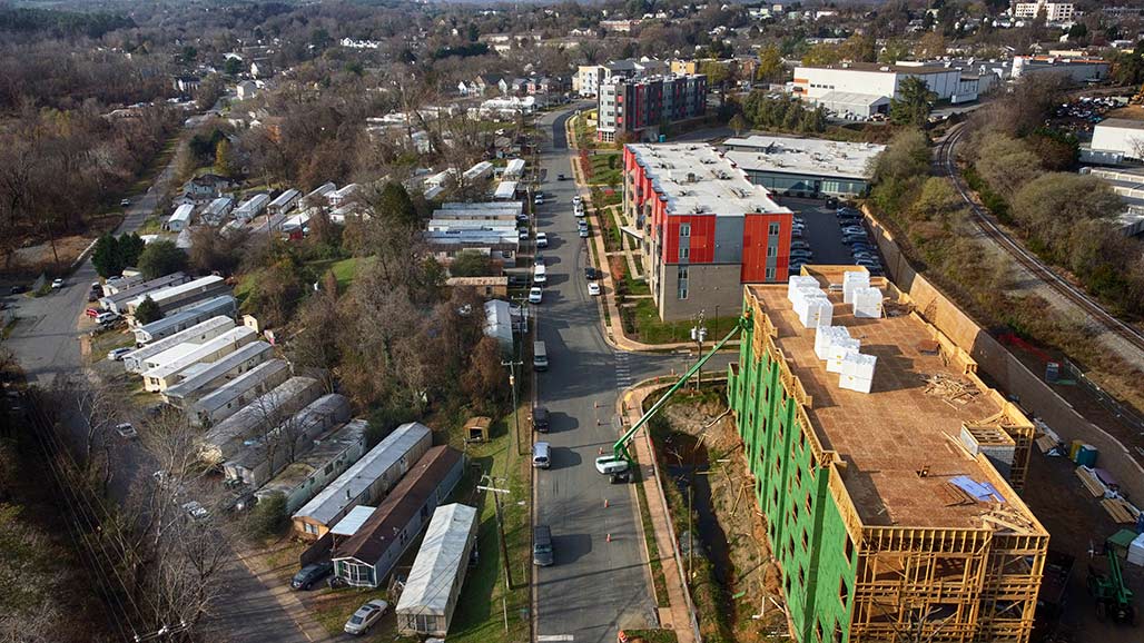
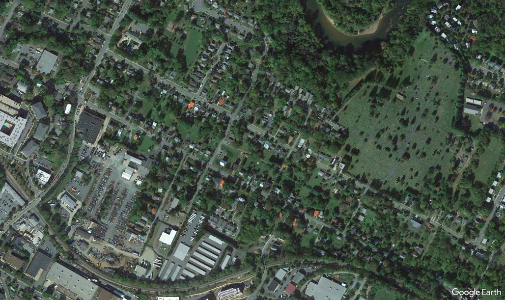
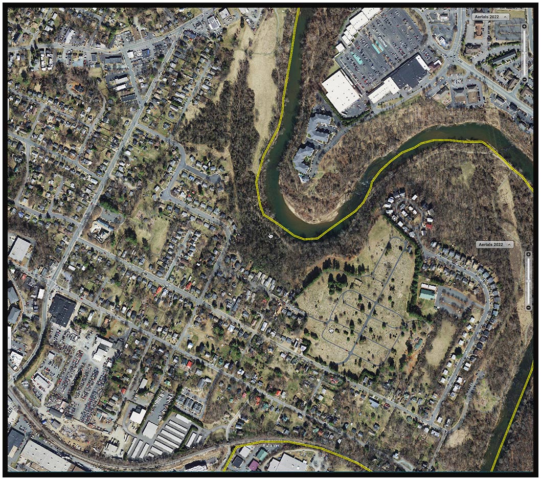
The land affected by split parcel zoning lies in the area of the Woolen Mills between Carlton Road and Franklin Street. It is the land north of the C&O railroad tracks and south of East Market. This acreage has been the seed for multiple conflicts in the past 35 years.

HBA

7 years before the annexation of the area in eastern Woolen Mills and Harland Bartholomew and Associates has a plan to line the south side of Market all the way to the Rivanna with Industrial.

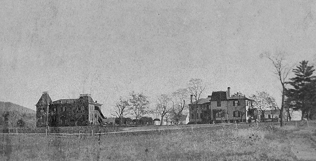
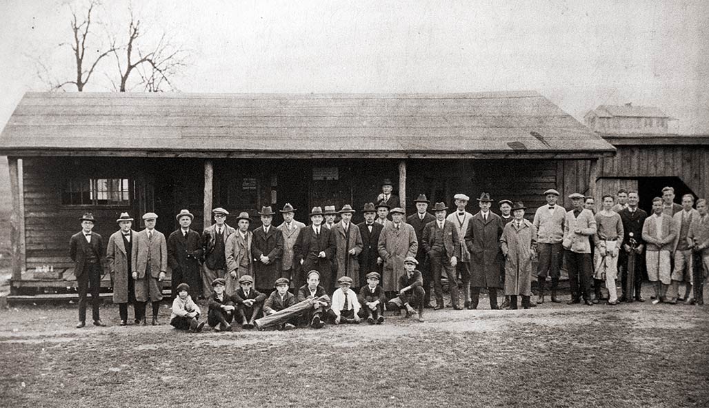
In the beginning, In the 1950’s, around the time that Council approved Harland Bartholomew’s “Workable Program for Urban Renewal” they looked down the road with guidance from HBA and made decisions regarding future zoning of Woolen Mills backyards.

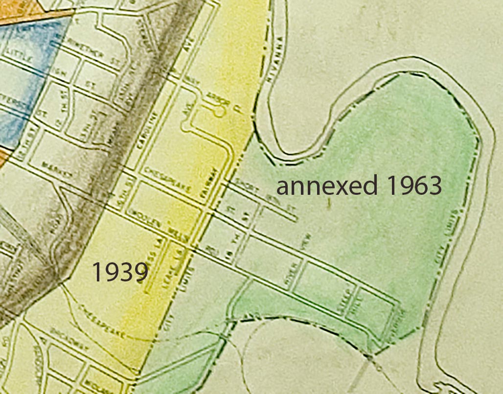
AlbCo adopted zoning in the late 1960s (1969?) Zoning wasn’t a concept familiar to Woolen Mills people, planning for the zoning was done to them in advance of the 1963 annexation. We are not aware of a public process.

xx

This is the region of split parcel zoning, residential in the north, industrial in the south.

xx

2013 ZM detail

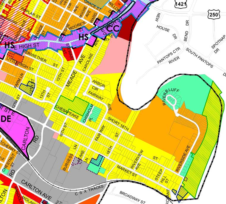
With the passage of the decades the green residential boundary bordering the southern edge of Market Street has gradually been eroded.


The proposed zoning map removes another 390 feet of the residential gateway to the neighborhood on the south side of Market. For decades we have fought lot by lot to determine the zoned future of the WMN.

xx


The current Council expresses the intention to remediate the damage done by their predecessors in the 1950s in selected neighborhoods. I wish that Council would act with an awareness that the damage of HBA’s planning advice extended beyond Charlottesville center city.
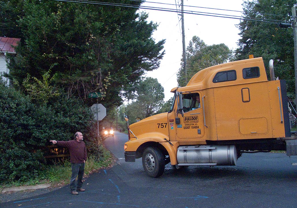
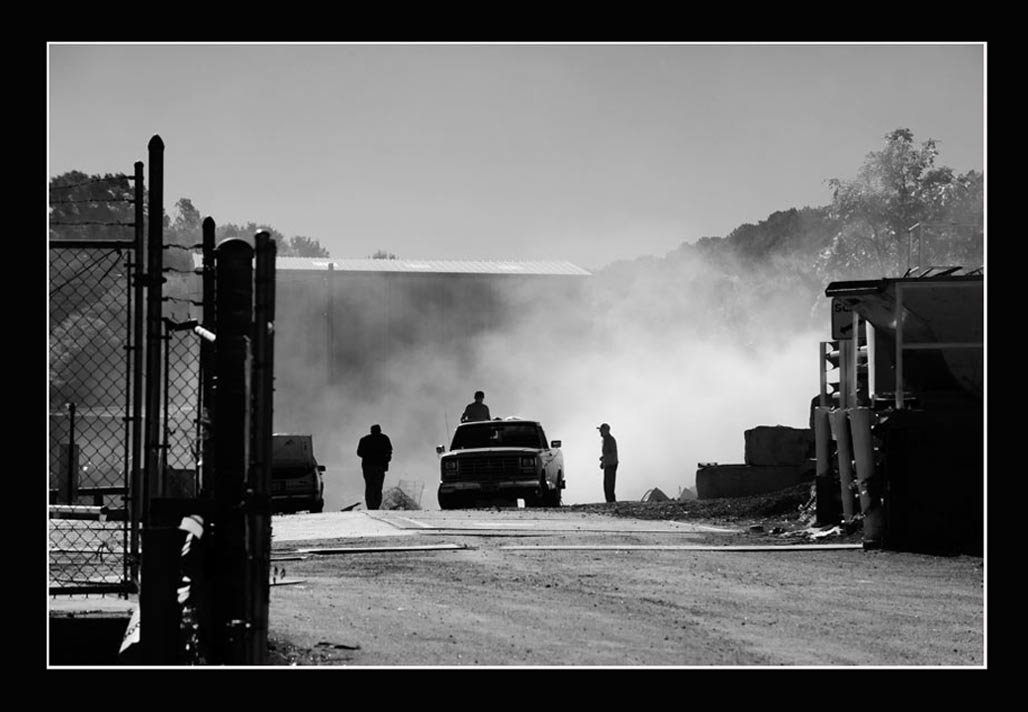
The split parcel zoning, residential contiguous to industrial, has resulted in numerous land use conflicts over the decades. Thousands of staff and resident hours have been invested in addressing the incompatible zoning district pairings in PUD, SUP, rezoning and BZA public hearings. There have been zoning violations and lawsuits. Neighbors have breathed particulates, smelled stink and been exposed to debilitating noise.

xx


The proposed zoning map needs adjustment in the Woolen Mills neighborhood.
1-pause the proposed Woolen Mills R-B zoning to avoid displacing current residents and motivating the destruction of modest homes. Talk to those who will be affected!
2-abide by the mapping logic and hold with NX-3 zoning instead of NX-8 for the Wright’s property. No ten story buildings at present!
3-Complete the Small Area Plan (SAP) formally requested by Joe Rhames on behalf of the Woolen Mills in August 1988 before up-zoning Woolen Mills residential properties beyond R-A.

Randy Scruggs

1609 E Market

Betty Lou and Randy

Lucian Randolph “Randy” Scruggs was born on October 6, 1936, to Lucian Scruggs Sr. and Virginia Hall Scruggs. He died on March 2, 2023.
Survivors include the love of his life, Judy Lang Scruggs; a daughter, Dr. Katherine Scruggs and her husband, Pete Smith, of Pittsburgh, Pa.; a granddaughter, Kristina Scruggs of Va. Beach, Va.; two grandsons, Patrick Scruggs and his wife, Nicole, of Richmond, Va., and Wyatt Smith of Pittsburgh, Pa.; a sister-in-law, Peggy Howdyshell and her husband, Dr. Larry Howdyshell, of Roanoke, Va., and Vicki Miller and her husband, Brian, of Charlottesville, Va., as well as a number of cousins, nieces and nephews. Randy was predeceased by his parents, Lucian and Virginia Scruggs; a sister, Betty Lou Scruggs; and a son, Rick Scruggs.
Randy lived in Charlottesville all his life where he attended McIntire School. He served in the Air Force in Korea. After his service in Korea, he worked for the U.S. Postal service for 33 years. After retiring from the Post Office, he worked at both Teague and Hill and Wood Funeral Homes. He attended University Baptist for a number of years, and belonged to Aldersgate United Methodist Church. He was a lifetime member of Elks Lodge # 389, and also belonged to the American Legion Post # 74 for over 30 years.
In his younger years, Randy was a master gardener, his gardens being the envy of the Woolen Mills Neighborhood. He enjoyed reading western novels, listening to country music and watching sports, especially the UVA Women’s Basketball teams.
Randy was generous to a fault. He lived his faith quietly and loved his family dearly and unconditionally.
In lieu of flowers, donations may be made to Aldersgate United Methodist Church, 1500 East Rio Road, Charlottesville, VA 22901 or St. Jude’s Hospital.
A visitation will be held from 6 until 8p.m. Monday, March 6, 2023, at Hill and Wood Funeral Home, 201 N. 1st St., Charlottesville, Va. Funeral services will be held 2 p.m. Tuesday, March 7, 2023, at Aldersgate United Methodist Church, 1500 East Rio Road, Charlottesville, VA 22901. A graveside service will follow at Riverview Cemetery, 1701 Chesapeake Street, Charlottesville, VA 22902. Condolences may be expressed to the family at hillandwood.com.

Attention to Detail

The smokestack one sees most prominently entering Charlottesville from the east on I-64. Nowadays, a favorite roosting spot for crows and black vultures

The Charlottesville and Albemarle Railway (C&A) was a short electric street railroad operating within the city of Charlottesville, Virginia, United States, during the early 20th century. The line was preceded by several streetcar lines operating both horse-drawn and electric powered cars dating back to 1887. After facing financial difficulties, the predecessor lines were reorganized into the C&A in 1903. The C&A’s electric streetcars operated off of an overhead line system that was powered by the railroad’s own power plant. The C&A also offered electric power generated by its plant to the city of Charlottesville. During the mid-1910s, the line received numerous upgrades, including the construction of a new power plant on the Rivanna River, a new company headquarters building, expansion of track, and the purchase of new streetcars.–Wikipedia

Holsinger Studio Collection, Albert and Shirley Small Special Collections Library, University of Virginia

Paul Goodloe McIntire’s Rivanna (10)

At Pantops, Mcintire was attentive to the vestiges of a prior institutional landscape and a set of buildings that could be adapted for the treatment of patients with mental illness. In 1877, Reverend Edgar Woods had purchased 373 acres at Pantops and opened Pantops Academy, a boys’ preparatory school, with close connections to the University of Virginia.

Pantops Academy

UVA Special Collections Pantops Academy

The Academy promoted the healthy, uplifting, character of the site–a setting and a rhetoric that could have easily been adapted from education to healing patients. In 1894, the Academy catalog declared, “The place formerly belonged to Thomas Jefferson, and is on the hill opposite his home, MONTICELLO. Its name was given by him for two Greek words, meaning ‘All seeing,’ in allusion to the prospect, which embraces the town of Charlottesville, the University of Virginia and a wide extent of plain and mountain scenery, not excelled by any other portion of the land. The surrounding region is one of the most healthy which the country contains, and is absolutely free from every kind of malaria …. It is scarcely possible to emphasize too much the unsurpassed location of the Academy, which not only delights the eye with the wide range and beauty of the landscape, but which ensures the best sanitary conditions, through perfect drainage and purest mountain air. Its distance from Charlottesville secures it from town temptations.” The Pantops Academy drew much of its food from its own farmlands declaring, “The teachers and pupils live together as one large family. The table is largely supplied from the farm, thus commanding abundance of milk and cream from its own dairy, fresh vegetables and fruit from its own garden and orchard and its fresh meat from its own flocks.”

Pantops Academy

Baseball team, Pantops Academy, 1892. University of Virginia, Holsinger Studio Collection

The Academy provided an indoor gymnasium but insisted that the site itself, with its elevated views, its hills, pastures, gardens, and river would provide for the healthy “physical culture” of the students with the “large grounds and the ample range the country thus affords.” Even though the Academy had closed in 1904, the prominent dorm and classroom building, built in 1884, and the rambling principal’s residence still dominated the site. Mcintire could imagine that they would be easily adapted for a psychiatric treatment hospital. Essentially what Mcintire could see in Pantops was what he had seen in the possibilities of a Rivanna public park–a landscape that would provide comfort and engagement and continue to cultivate the vital historical relationship between people in the region and their river.

Rivanna

Rivanna at Riverview Park. Montalto in the distance.

It was only a matter of months between Mclntire’s Pantops purchase in July 1929 and the crash of the stock market. In the midst of the Depression, the University was not able to expand to Pantops, and in 1937 the University’s Board of Visitors resolved to sell Pantops to James H. Cheek for use as a private country estate and horse farm. The proceeds of the sale were devoted to the development of psychiatry at the University hospital. In the late twentieth and early twenty-first century, Pantops was divided for private residential and commercial developments. State Farm Insurance opened a regional headquarters on part of the land in 1979. The Pantops Shopping Center opened in 1984. The Westminster Canterbury Retirement Community opened in 1990 and the new Martha Jefferson Hospital moved to Pantops in 2011. By 2010, Free Bridge carried an average of 38,000 cars a day over the Rivanna between Pantops and Charlottesville; however, the automotive landscape that gripped the river and determined adjacent lands uses did little to connect people to this particular and special place or to the Rivanna itself, with its rich historical, cultural, and environmental resources.

Pantops sidewalk

Sidewalk to the summit.

Mclntire’s vision for the Rivanna embodied a complex ideal concerning the proper relationship between the Rivanna, the broader development of the city, and the citizens of Charlottesville. Interestingly, the person who enacted part of this vision in the wake of Mclntire’s failure was John Wesley Bagby (1888-1968), a life-long employee of the Charlottesville Woolen Mill, who labored initially as a mill hand and became the superintendent of the dye works. In 1928, Bagby purchased 23 acres of the Albemarle Golf Club lands along the Rivanna for $3,000. Around 1940, Bagby began using his land as a site for periodic circuses and carnivals. This tradition lasted for half a century. When the three-ring Barnum and Bailey circus visited in 1954, the enormous circus tent pitched on the banks of the Rivanna, just south of Free Bridge, would accommodate 10,000 spectators who came to see elephants, tigers, clowns, and high-wire gymnasts perform. Here was a vision of a city gathering along the river for amusement, entertainment, relaxation, and neighborly socializing. But even these events only took place periodically.

Circus grounds

Bagby’s Circus Grounds 2014

The rising national environmental movement began to frame local connections to the Rivanna from the 1960s onward. The Virginia Assembly passed the Scenic River Act in 1970; the Act required that scenic values be considered in public planning decisions around designated scenic rivers and established regulations to prevent the construction of dams that impeded the flow of water on scenic rivers. The section of the Rivanna River in Fluvanna County was designated in 1974, and the designation was moved upstream to the dam at the Charlottesville Woolen Mills in the late 1980s and to the South Fork Reservoir Dam in 2009; this later designation was granted after the Woolen Mills Dam was removed in 2007 to promote the ecological health of the river and its fish population. The opening of a jointly purchased city-county park in 1986, now named Darden Towe Park, prompted a series of initiatives in the 1980s and 1990s to open trails along the Rivanna with legal easements over privately held property. The trails now amount to ribbon parks and are popular for outdoor exercise, walking, running, and biking.

Birders

Birders

The environmental focus on the Rivanna River is a much narrower vision than Paul Goodloe Mcintire had tried to effect. When Charles Hurt filed plans for the Pantops Shopping Center in the 1980s, people advocating for the Rivanna’s ecology opposed the plan, worrying about pollution, run-off, and flooding. The Rivanna represented a problem and a threat for the Pantops Shopping Center development. The Center ended up being constructed with its back to the Rivanna, largely disengaged from the river.
Mclntire’s failed 1920s plans for connecting the city and the Rivanna represented a more complex integrated vision that reflected the historical realities of the river’s significant place in the region. The vision saw people living, working, recreating, and being healed in a landscape that intermingled human artifice with a key environmental and cultural system-the Rivanna River. In the early twentieth-first century, the Rivanna is part of many people’s lives in the region. When they turn on the tap in their sinks, water arrives from the South Fork of the Rivanna River. When their streets and houses shed rainwater, or when they flush their toilet, they send away liquid waste that eventually ends up in the Rivanna. And yet relatively few people really experience, know, or understand the Rivanna River. The rise of the single purpose planning, for recreation, water supply, sewage disposal, transportation, and housing has exacerbated this reality. When Mclntire’s vision for the Rivanna failed, many citizens in Charlottesville lost sight of their history and their river.

Rivanna

The Rivanna behind Riverbend Shopping Center

Paul Goodloe McIntire’s Rivanna: The Unexecuted Plans For a River City is by Daniel Bluestone and Steven G. Meeks. This article was published in Volume 70 2012 of the Magazine of Albemarle County History by the Albemarle Charlottesville Historical Society. Copies of the Magazine are available at www.albemarlehistory.org

Paul Goodloe McIntire’s Rivanna (09)

Paul Goodloe Mclntire’s ambitions for the Rivanna River did not end even after he established the public park north of downtown in 1926. In July 1929, Mcintire purchased a 362-acre tract of Pantops, including an expansive frontage on the Rivanna River. He donated the land to the University of Virginia in the hope that the University would establish a psychiatric hospital on the land. This land at Pantops had a storied history stretching back to the eighteenth century. Thomas Jefferson inherited the land from his father. From the edge of the Southwest Mountains, Pantops offered sweeping views of the Rivanna and the surrounding region. In 1797, Jefferson deeded Pantops to his daughter Maria as a dower gift for her marriage to John Wayles Eppes. Jefferson later leveled a house site at the top of Pantops, expecting Maria and her husband to build a house and settle there, within view of Monticello. Maria died in 1804, however, and the house was never built. Pantops continued in intensive agricultural production. In 1860, Meriwether Lewis Anderson, his family, and his slaves operated a large plantation at Pantops with 14 horses, 11 milk cows, 12 oxen, 10 beef cattle, 53 sheep, and 115 pigs. In 1860, they harvested 15,000 pounds of tobacco, 2,400 bushels of wheat, 3,000 bushels of corn, 1,500 bushels of oats, and 30 tons of hay. They also cultivated potatoes, fruit from an orchard, and produced 850 pounds of butter and 250 pounds of honey.

In 1929, Mcintire envisioned an institutional and healing landscape at Pantops that could accommodate patients suffering from mental illness and promote the “teaching of psychiatry and nervous diseases in general.” There was personal poignancy behind his plan; Mclntire’s daughter, Virginia Charlotte Mcintire, had entered Richmond’s Westbrook Sanatorium in 1921, at the age of twenty, and was still living there eight years later when McIntire purchased Pantops.

Development of Pantops

Not what Jefferson or McIntire intended.


Paul Goodloe McIntire’s Rivanna: The Unexecuted Plans For a River City
is by Daniel Bluestone and Steven G. Meeks. This article was published in Volume 70 2012 of the Magazine of Albemarle County History by the Albemarle Charlottesville Historical Society. Copies of the Magazine are available at www.albemarlehistory.org

Paul Goodloe McIntire’s Rivanna (08)

McIntire Park
Mclntire’s failure to purchase parkland along the Rivanna delayed the opening of a major landscaped park in Charlottesville for six years. In January 1926, Mcintire purchased a 92-acre section of the Old Mason Farm located north of Charlottesville. The Mason site had the rolling meadowland character the land along the Rivanna; however, it lacked the diversity found along the Rivanna with its old “prime Forest,” steep hillside, riverside pastures, rock outcroppings, and the well-established sod. Schenk’s Branch, a tributary to Meadow Creek (and to the Rivanna beyond) bounded the eastern edge of what became Mcintire Park. It was relatively modest in size and lacked the majestic river bends and cultural significance of the Rivanna. Moreover, the short interval between the establishment of the park and the collapse of local building caused by economic crash of 1929 meant that the city’s development did not really extend out to and around Mcintire Park until after World War II. If the Rivanna park had been established in 1920 it would have provided a magnet for the 1920s residential boom. The east end of Charlottesville would have been organized differently. It would have developed with the park and river as an essential presence, shaping the layout of street, block, and lot development and reaffirming the vital historical connections between the people in Charlottesville and the Rivanna. This possibility was presaged by the Charlottesville Land Company’s 1892 subdivision, The Farm; however, the connections would have been much stronger with Mclntire’s vision of a public park than developer’s plan for the private villas imagined in The Farm subdivision.

road being built through park 2014
Paul Goodloe McIntire’s Rivanna: The Unexecuted Plans For a River City
is by Daniel Bluestone and Steven G. Meeks. This article was published in Volume 70 2012 of the Magazine of Albemarle County History by the Albemarle Charlottesville Historical Society. Copies of the Magazine are available at www.albemarlehistory.org

Paul Goodloe McIntire’s Rivanna (07)

Lee statue silhouette
In 1920, Paul Goodloe McIntire approached the Albemarle Golf Club with an unusual proposition. He wanted to buy their five-year-old golf course and donate the land to the people of Charlottesville for use as a public park. The site was quite distinct from the two parks that McIntire had already donated to Charlottesville. In 1917, McIntire had purchased the historic Southall-Venable house, which occupied a full block in the grid plan of downtown Charlottesville, at Second and Market streets. Located two blocks east of Court Square, McIntire had the residence demolished and developed the square as a single block park to memorialize both his parents and Robert E. Lee. The Lee equestrian monument was completed in 1924. In 1918, McIntire purchased several houses along McKee Row, facing Court Square. Again, after demolishing the houses, he had the site landscaped as a park and he commissioned an equestrian statue to honor Thomas “Stonewall” Jackson, which was dedicated in October 1921. In 1919, McIntire built a public library on a lot facing Lee Park. The library joined churches, the post office, the courthouse, private law and business offices, and several residences that tightly bounded Jackson and Lee parks. These parks stood in the midst of the most densely built up area of Charlottesville.

McIntire envisioned something completely different for the large, landscaped park he hoped to develop along the Rivanna. Undoubtedly, many of the same features that attracted members of the golf club to the site also appealed to McIntire. The land had a highland section, next to the Riverview Cemetery; it had a steep sloped area, vestiges of the “prime Forest” that Thomas Farish had sought to preserve with its mature trees, rolling meadowland, expansive sodded areas, and a long river frontage on the Rivanna. This sort of topographical variety and expansiveness characterized the sites of some of the most celebrated landscaped parks that had constituted the landscape park movement in United States, which had originated in the mid-nineteenth century.
quercus rubra Rivanna's edge

Preserving land for public parks in the face of urbanization in cities like Boston, New York, Philadelphia, Chicago, St. Louis, or Richmond certainly had much greater urgency than was apparent in late nineteenth and early twentieth century Charlottesville. The combined Charlottesville and Albemarle County population rose relatively slowly from 32,379 in 1890 to 36,693 in 1920. The city population rose from 5,591 in 1890 to 10,688 in 1920; however, a fair amount of the city’s increase came not through actual growth but through annexing the more densely settled parts of the county located immediately outside of the city’s corporate limits. In every direction, open agricultural land closely surrounded the settled parts of Charlottesville. Outdoor recreation and natural or agricultural scenery was easily accessible on all sides of the city. Indeed, the failure of the Charlottesville Land Company’s 1890s development of The Farm, followed in 1915 by the laying out of the golf course, underscored the distinction between small-town Charlottesville, with open pasture lands immediately adjacent to the downtown, and larger metropolitan centers where the agricultural landscape was entirely filled with building and street development. What is notable about Mclntire’s vision of a large landscaped park on the Rivanna was that it seemingly stemmed from his cosmopolitan sensibility gathered in his life in Chicago and New York and through European travel. It also reflected Mclntire’s deep optimism about the metropolitan future of Charlottesville, his childhood home. Mclntire’s City Beautiful campaign for Charlottesville involved giving the city the trappings of a larger and wealthier city. Thus, the landscaped park was, in large measure, less about pressing current needs than about a cosmopolitan gesture towards future urban attainment. The Daily Progress insisted that Mclntire’s plan would remedy one of the city’s “most serious deficiencies.” The newspaper recognized the park as yet another element in its acquisition of the trappings of cosmopolitan identity: “Although the people of this city have had every reason to be proud and gratified at the many bountiful provisions that have been made for them by the forethought and filial attachment of Mr. Paul Goodloe McIntire, that generous gentleman and citizen bountiful has realized the fact that without a public park the full measure of benefits most needed has not been made up.”

The Daily Progress confidently anticipated that the golf club membership would come to terms with McIntire for the conversion of the golf course into a public park because the club had so many members “noted for public spirit and a willingness to advance the city’s interests.” When negotiations began in April 1920, consensus and public spirit proved rather elusive. Initially, the members wanted McIntire to leave in place a nine-hole golf course­ essentially merging his public park with their golf club. McIntire responded that his park plan would require all of the club’s land and he asked them again to name a price for their land. The club then asked that McIntire buy land for the relocation of the golf course and agreed to exchange the Rivanna property for a new property. McIntire informed the leadership of the club that he considered their property “the most desirable site” for the “laudable purpose” he had in mind but he rejected a property exchange and again asked the club to name their price for their Rivanna land. Members were split on Mclntire’s offer and at first narrowly voted against a sale. Then they settled on an alternative. They would insist on continued free use of the course for the next three years, agreeing to sell the tract to McIntire for $55,000. The asking price was nearly three times the purchase price paid for the land just two years earlier. McIntire rejected the offer. Three months later, in July 1920, McIntire contacted the club’s officers again and suggested that they enter arbitration by neutral parties to arrive at a fair price for the land. The club felt that arbitrators might settle on a fair price but that would not solve the club’s problem of finding, and paying for, an appropriate alternative site. Rather than exercising “public spirit,” the club members rejected Mclntire’s effort to establish a public park on the Rivanna. The club maintained its riverside links, but only for seven more years. In 1927, the club merged with the group that established a new golf club at Farmington, west of Charlottesville. The new course relied on automobiles for access. The earlier idea of walking from downtown businesses to the Rivanna for outdoor leisure ended, disrupting a vibrant relationship between people living and working in central Charlottesville and the river that had helped define the region for centuries.
Rivanna River regatta 2006

Paul Goodloe McIntire’s Rivanna: The Unexecuted Plans For a River City is by Daniel Bluestone and Steven G. Meeks. This article was published in Volume 70 2012 of the Magazine of Albemarle County History by the Albemarle Charlottesville Historical Society. Copies of the Magazine are available at www.albemarlehistory.org

Paul Goodloe McIntire’s Rivanna (06)

Henry Clay Marchant grave

In 1915, five years after Henry Clay Marchant’s death, his heirs turned the riverside land over to a group that saw in it a great aesthetic and recreational resource. The heirs leased, and later sold, the Marchant tract to the Albemarle Golf Club. Established in 1914, the club had enjoyed rapid growth, initially using leased land on Rose Hill. In 1915, George R. B. Michie, a charter member of the club and the president of the People’s National  Bank, approached the Marchant heirs and worked out a three-year lease for their land along the Rivanna River. For Michie, the arrangement seemed ideal. In 1909, Michie and his family had taken up residence in the 1820s house built by John A. G. Davis as the plantation house of The Farm.

Davis house aka the Farm

The house continued to look out over sod and pastures that the Marchant family had maintained since the 1890s. Now, with only minor changes, the landscape character would be preserved, and Michie would have the added advantage of having a golf course adjacent to his residence. For their part, the Marchant heirs insisted on preserving the pastoral character of the site. Their lease called for the land to be used for “athletic and grazing purposes only, and shall not be cultivated except so far as is necessary to get said land in the best condition possible for the raising of grass and sodding said land.” The sod could be removed only to build tennis courts and putting greens, and would have to be restored at the end of the lease. The existing grade of the land could not be altered, and no trees could be felled, save for a small orchard that could he removed if the golfers desired.

The rising popularity of golf in the late nineteenth and early twentieth century was directly tied to the perception that urbanization would erode the health and vitality of the American citizens. A growing number of people who had been raised in the outdoors, on rural farms, had now taken up residence in cities and were spending their working lives indoors. This fact made the golf course seem an especially attractive venue for such city-dwellers to ensure healthy and restorative leisure. Pointing to the new golf course along the Rivanna, the Daily Progress reported: “The new grounds are within a short walking distance from the business center of Charlottesville ….The club is meeting a long-felt want in this community-that of furnishing healthful outdoor exercise for business and professional men who are kept in store or office during the major portion of the day.”  Many charter members of the Golf Club did indeed spend their days indoors doing white-collar work. For example, George Michie worked in the People’s National Bank at Third and Main. Marshall Timberlake ran his pharmacy  at Fourth  and Main. W.J. Keller  and  Harry  George operated their Main Street jewelry shop between Second Street and Third Street. All of these men lived within a few blocks of their workplace . All could now golf along the Rivanna where tennis, baseball, and boating were also available. Clearly, the Golf Club represented a new use for the agricultural lands along the Rivanna. Indeed, despite the appearance of the land that seemed somewhat pastoral in nature, the Marchant heirs had forbidden  the planting of corn on the site and in 1915 after a “very rigorous debate,” club members voted to terminate the pasturage of cows on the land, preferring to pay for the mowing of the fairways. Under these changed circumstances, the agricultural landscape grew increasingly attenuated; nevertheless, with the introduction of golf, the site retained both its alluring pastoral character and its intricate connection to the economic, residential, and social life of the region. In 1918, pleased with their location and the growth of their organization, the Albemarle Golf Club paid the Marchant heirs $18,800 and took full ownership of their riverside golf course.

Alb Golf club members

Members of the Albemarle Golf Club, 1921. Although not pictured, women could join the club as non-voting members, paying half the annual membership fee of men while the entrance fee was waived. Photo courtesy collection of the Albemarle Charlottesville Historical Society.

Paul Goodloe McIntire’s Rivanna: The Unexecuted Plans For a River City
is by Daniel Bluestone and Steven G. Meeks. This article was published in Volume 70 2012 of the Magazine of Albemarle County History by the Albemarle Charlottesville Historical Society. Copies of the Magazine are available at www.albemarlehistory.org