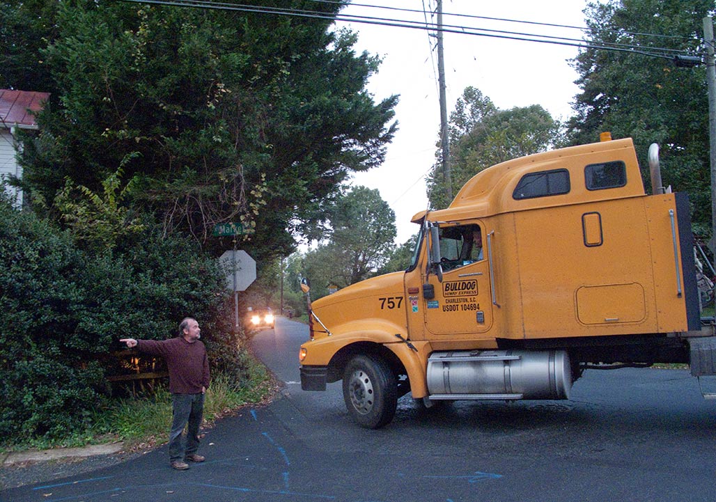
Tool Use

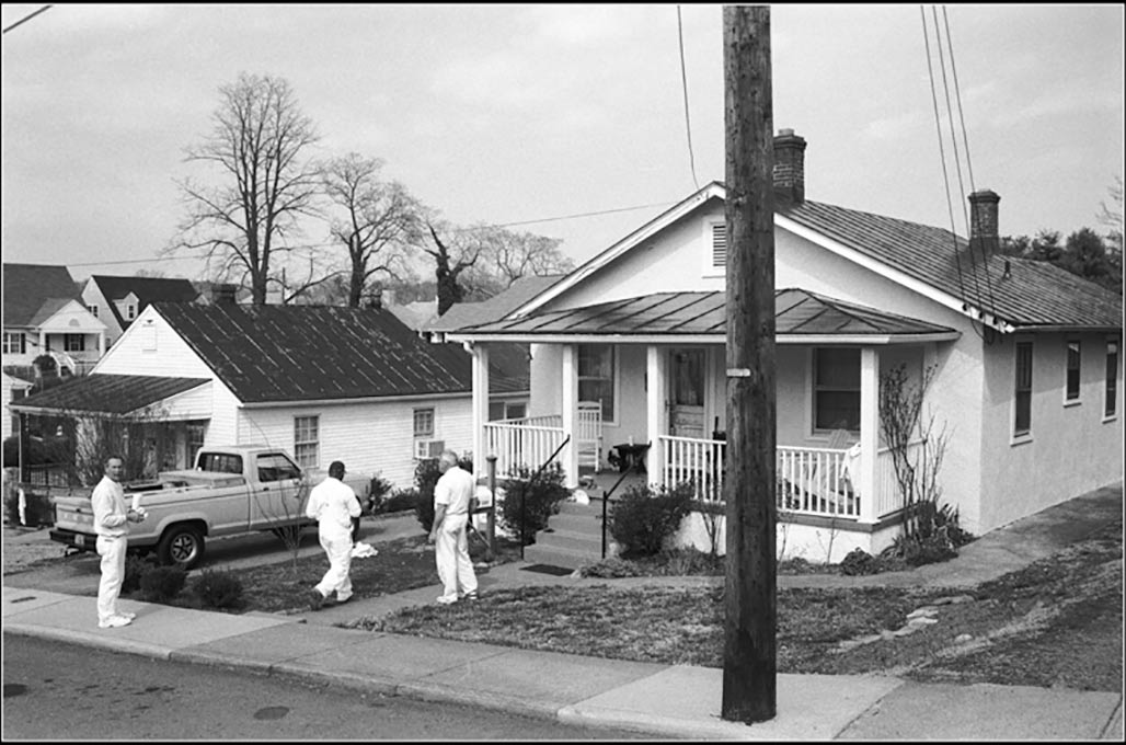
At this point the driver has failed to see several signs regarding street usage. Tell them, tell them again, tell them again

Zoning is a tool that legislators use to direct the day to day life in their territory. Zoning can be a glass of water for a thirsty person or club against the head of an enemy.
For 40+ years, neighbors have corresponded with legislators and folk in Government about Woolen Mills zoning. This year, an advisory board member responded (thank you Lyle) but otherwise, no member of the City Council, of the deciders, has chosen to engage us in conversation.
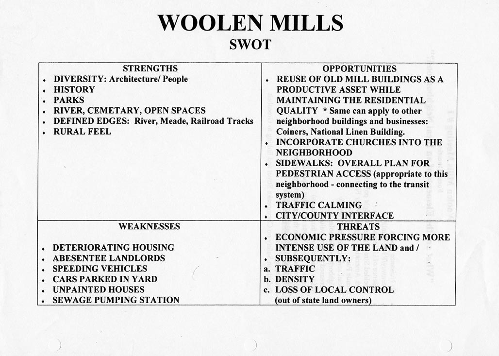
In 2000, for the Comprehensive Plan, NDS came to the neighborhood and requested input. It was a different era.

This post is a cursory examination of zoning when used without the consideration of The People whose neighborhood will be shaped by the zoning. We are interested in why zoning practice is repeatedly bad zoning practice. We interact and interact and little changes.
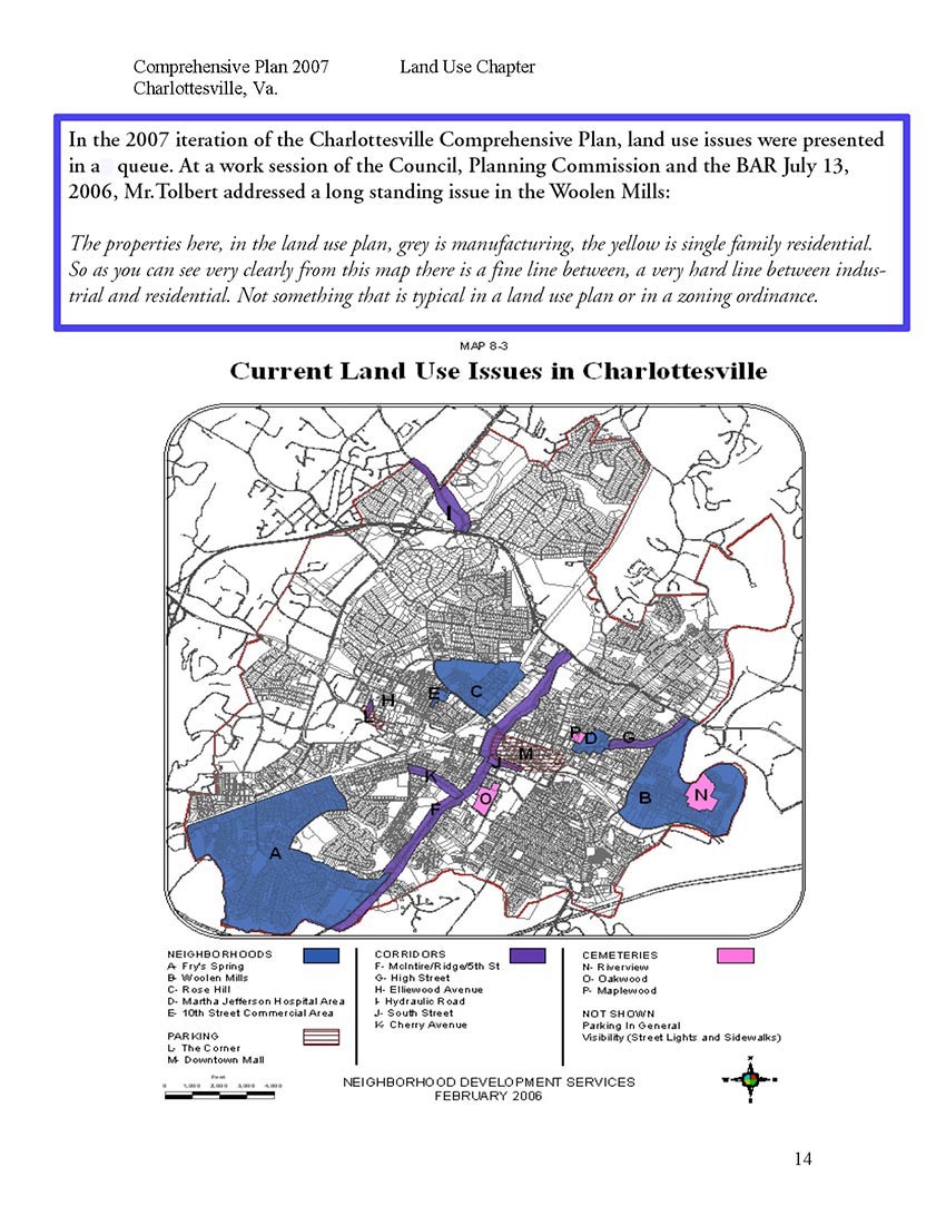
Mr.Tolbert on the “very hard line between industrial and residential.” Now the hard line is between IX-5, NX-3 and residential. Carrying forward the vision of Council from 1957.

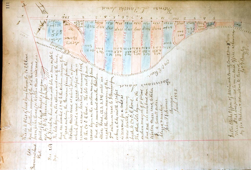
South of Market Street/Woolen Mills Road subdivision plat

A neighborhood is a living thing composed of topography, culture, people, plants, pathways, businesses, animals and architecture. Neighborhoods require planning and care. It has been So Discouraging trying to obtain planning and care from our City. Neighborhoods are sensitive.
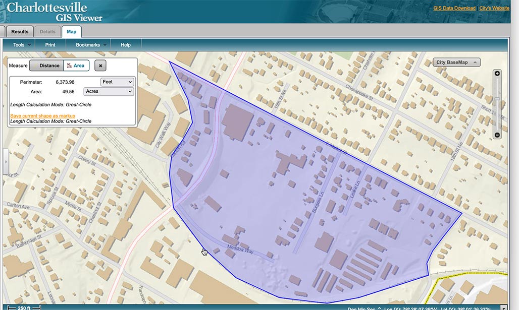
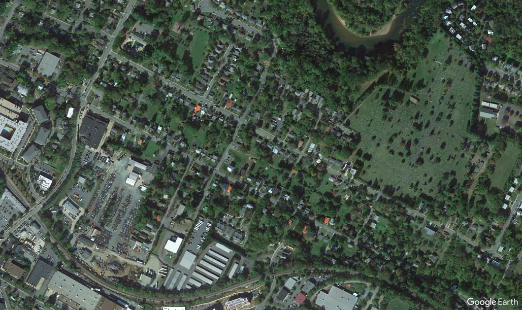
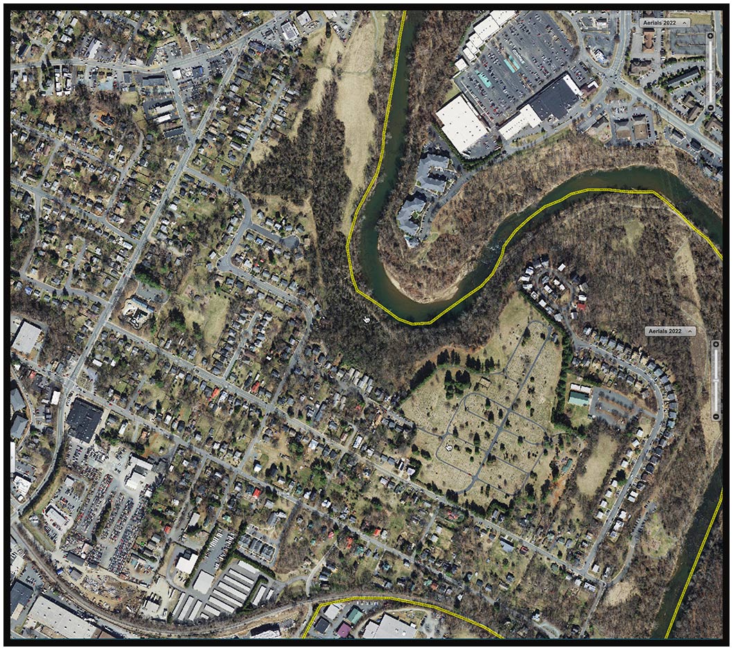
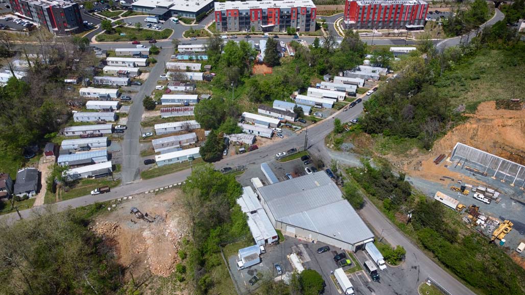
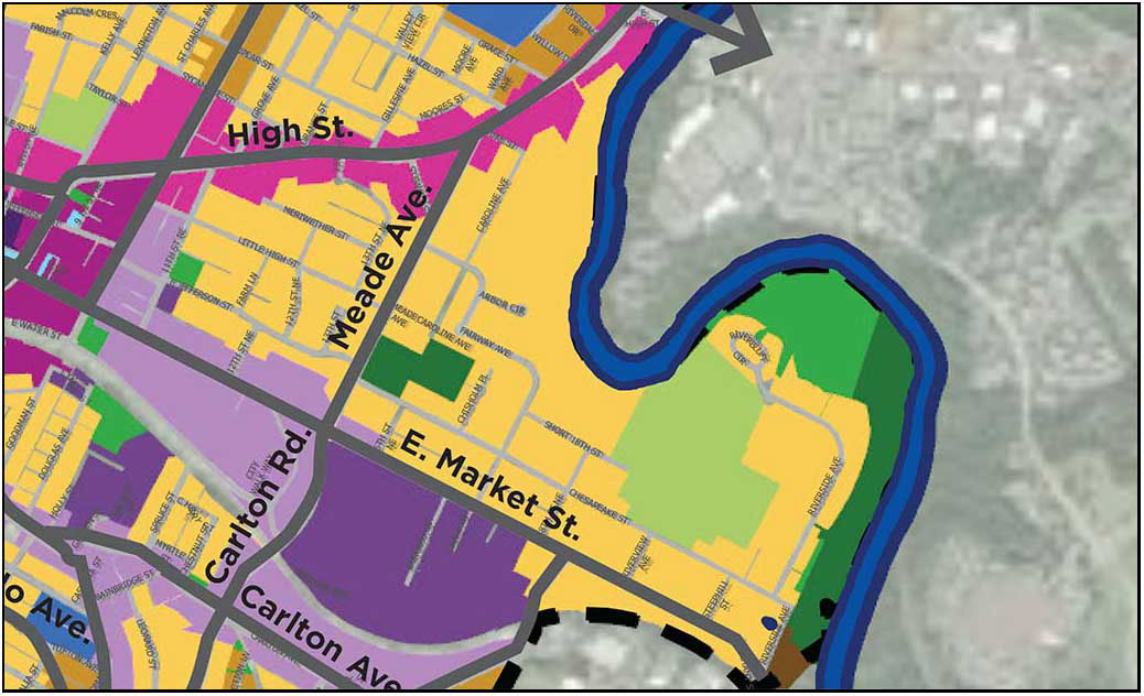
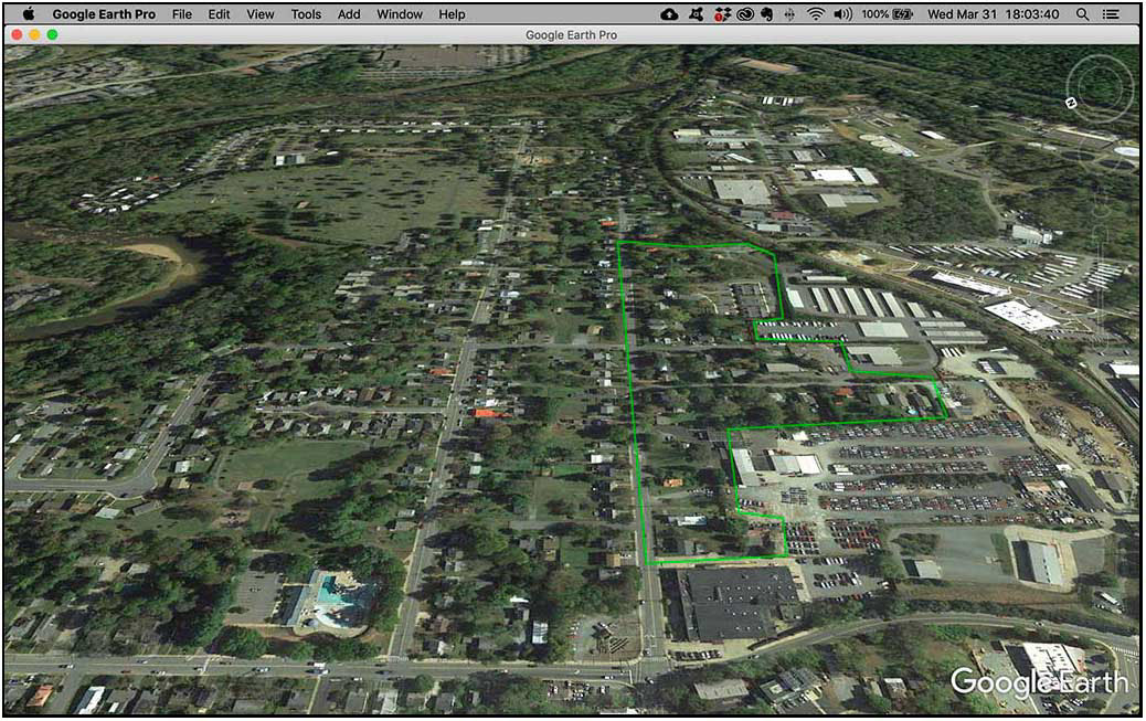
The land affected by split parcel zoning lies in the area of the Woolen Mills between Carlton Road and Franklin Street. It is the land north of the C&O railroad tracks and south of East Market. This acreage has been the seed for multiple conflicts in the past 35 years.

HBA

7 years before the annexation of the area in eastern Woolen Mills and Harland Bartholomew and Associates has a plan to line the south side of Market all the way to the Rivanna with Industrial.

In the beginning, In the 1950’s, around the time that Council approved Harland Bartholomew’s “Workable Program for Urban Renewal” they looked down the road with guidance from HBA and made decisions regarding future zoning of Woolen Mills backyards.
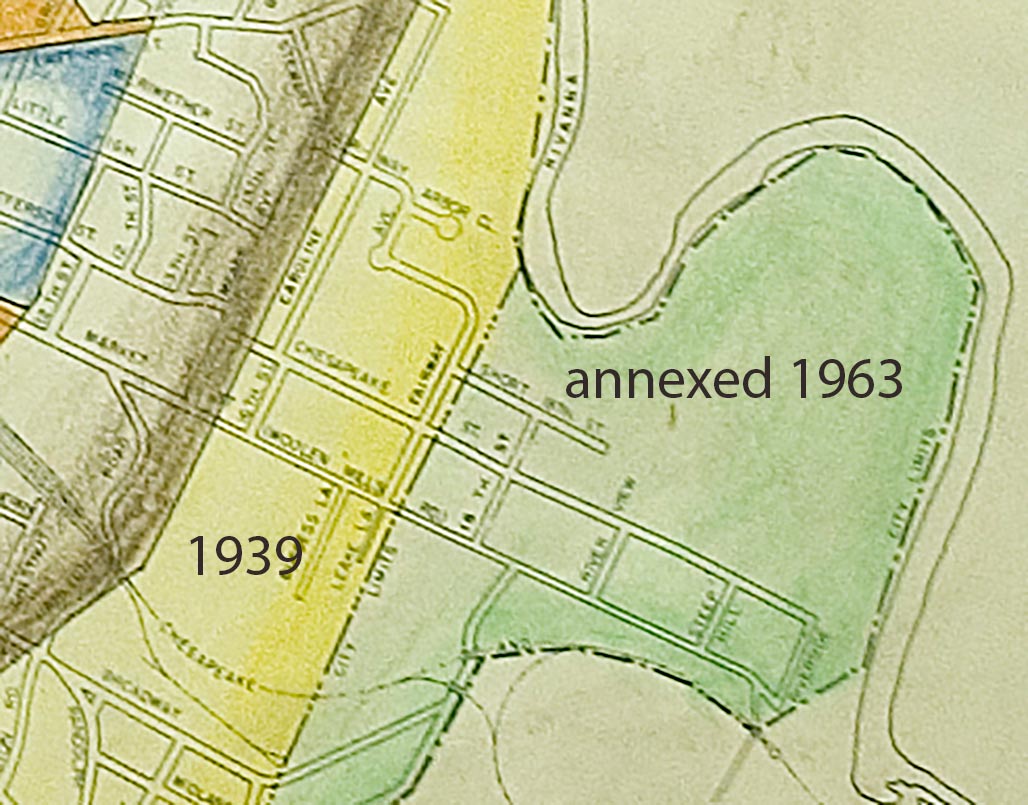
AlbCo adopted zoning in the late 1960s (1969?) Zoning wasn’t a concept familiar to Woolen Mills people, planning for the zoning was done to them in advance of the 1963 annexation. We are not aware of a public process.

xx

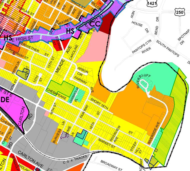
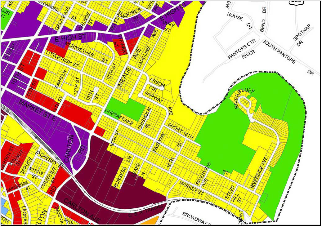
This is the region of split parcel zoning, residential in the north, industrial in the south.

xx

2013 ZM detail

With the passage of the decades the green residential boundary bordering the southern edge of Market Street has gradually been eroded.
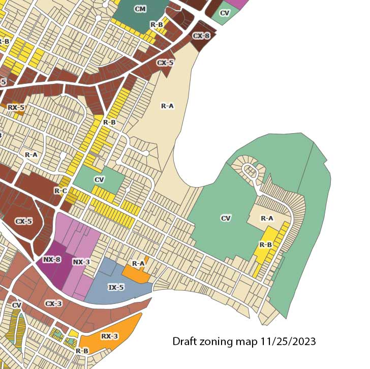

The proposed zoning map removes another 390 feet of the residential gateway to the neighborhood on the south side of Market. For decades we have fought lot by lot to determine the zoned future of the WMN.

xx


The current Council expresses the intention to remediate the damage done by their predecessors in the 1950s in selected neighborhoods. I wish that Council would act with an awareness that the damage of HBA’s planning advice extended beyond Charlottesville center city.
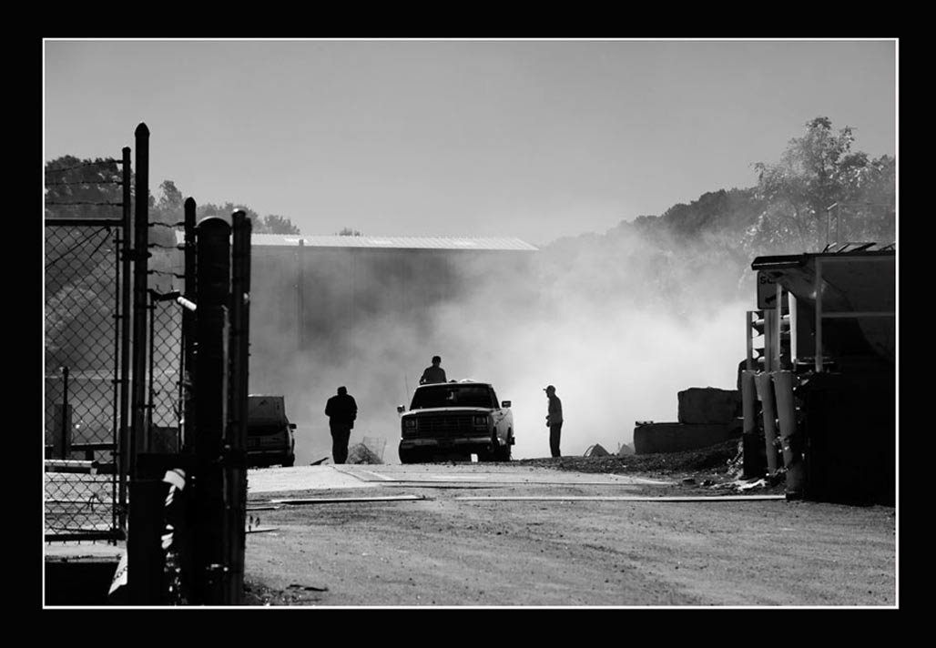
The split parcel zoning, residential contiguous to industrial, has resulted in numerous land use conflicts over the decades. Thousands of staff and resident hours have been invested in addressing the incompatible zoning district pairings in PUD, SUP, rezoning and BZA public hearings. There have been zoning violations and lawsuits. Neighbors have breathed particulates, smelled stink and been exposed to debilitating noise.

xx


The proposed zoning map needs adjustment in the Woolen Mills neighborhood.
1-pause the proposed Woolen Mills R-B zoning to avoid displacing current residents and motivating the destruction of modest homes. Talk to those who will be affected!
2-abide by the mapping logic and hold with NX-3 zoning instead of NX-8 for the Wright’s property. No ten story buildings at present!
3-Complete the Small Area Plan (SAP) formally requested by Joe Rhames on behalf of the Woolen Mills in August 1988 before up-zoning Woolen Mills residential properties beyond R-A.

Local News

Rivanna River

Rivanna River

honey truck

septage hauler

Tomorrow night, City Council is expected to officially refer the new “Development Code” to the City Council.
Local journalist Sean Tubbs is interested in receiving community responses to a line in the staff report which accompanies the Development Code, it reads:

“There has been extensive community engagement over the entire time period of the Cville Plans Together process as well as specifically in relation to the Zoning Ordinance,”

Please let Mr. Tubbs know what you think.

230807 staff report

visualization Chesapeake and Meade


Since the city and consultants first introduced the Future Land Use Map in 2021, right up until the most recent pop-ups held by consultants and NDS on the Draft Zoning Ordinance (DZO), residents have asked for visualizations of what actual Charlottesville streetscapes could look like under the new regulations. Neither the city nor its consultants have obliged. We believe that while visualizations do not function as arguments for or against the DZO, they are an indispensable tool for residents trying to form an opinion on various aspects of the proposal. We have therefore prepared several simulated visualization of specific blocks in Charlottesville — both to provide the tools that residents asked for and didn’t get and to show that there was no difficulty involved in preparing visualizations that could have reasonably prevented a competent consultant or NDS department from providing them. You can find the videos below. We anticipate the we will add more over time. If you have an area for which you’d like to see a visualization, please reach out to us via email. Please bear in mind that the purpose of the videos is to help give viewers a concrete sense of height, massing and coverage. These are not architectural renderings or surveys and are necessarily approximate. We do not suggest that the generic 3D models we used are predictive of the architectural styles developers would use or that the blocks we simulate are more likely than others to be redeveloped.–A Nonymous

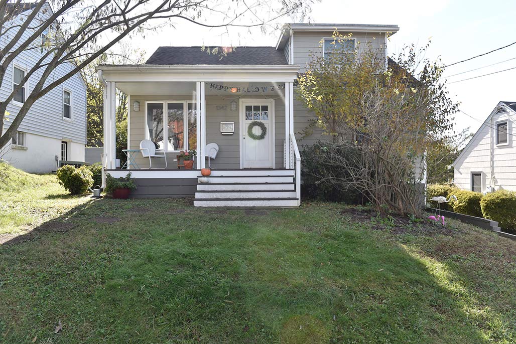
The houses on Meade and Chesapeake that are to be loaded with R-B and R-C zoning are and have traditionally been the houses of working people. They are peoples homes.

petition to dial back proposed zoning

Changeless change

City County boundary

Franklin Street is the City County boundary.

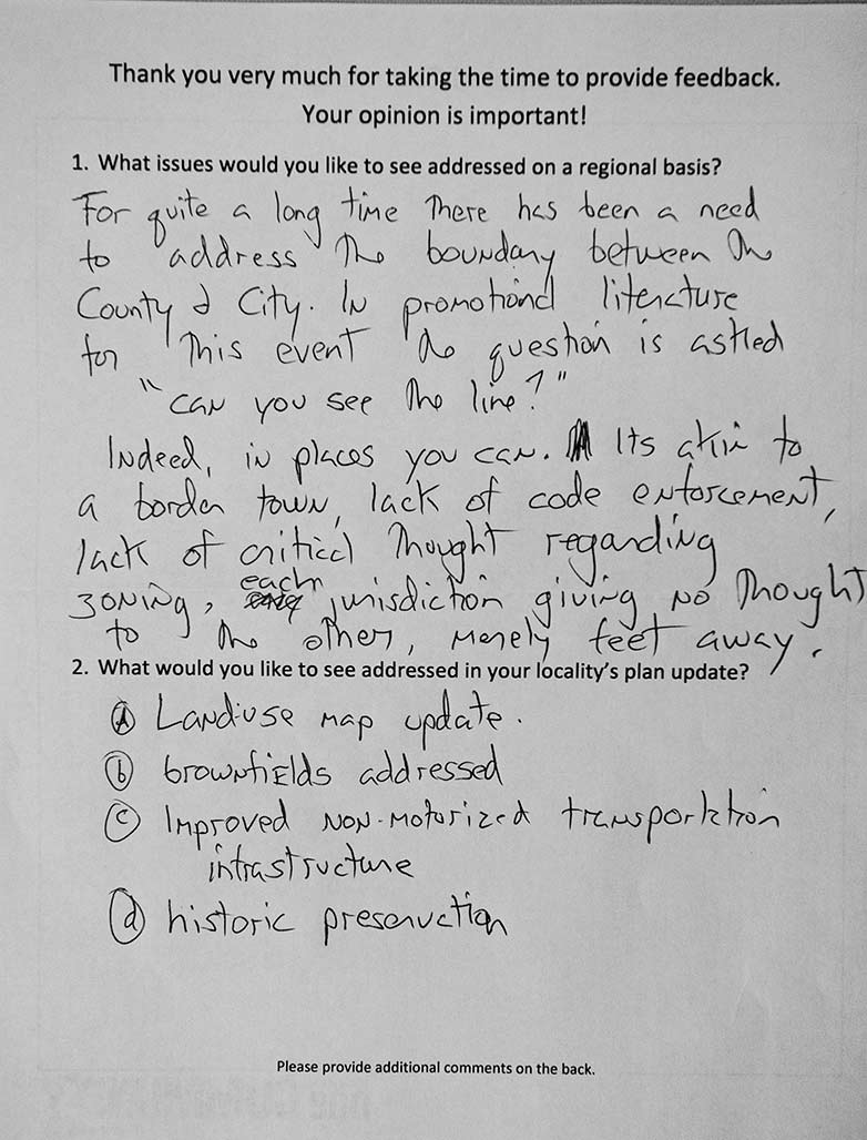
Many plans, one community, an aspirational name for a government program, Charlottesville and Albemarle syncing the development of their Comprehensive Plans. The request for comment form from a meeting in April 2011. Much remains to be fixed.

bye bye


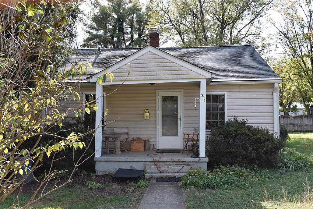
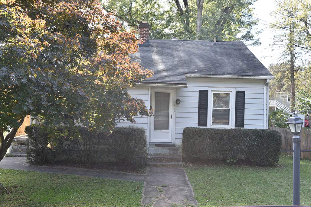
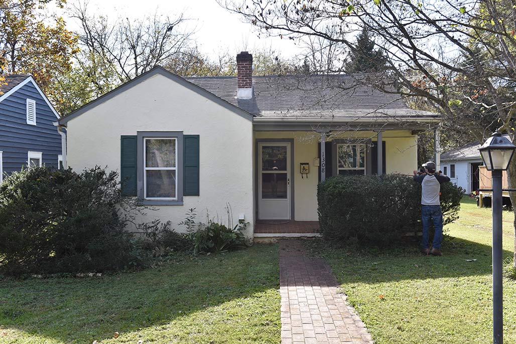
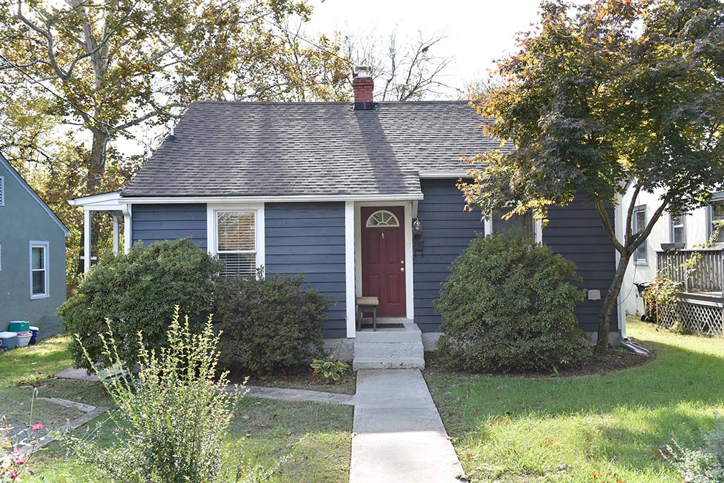
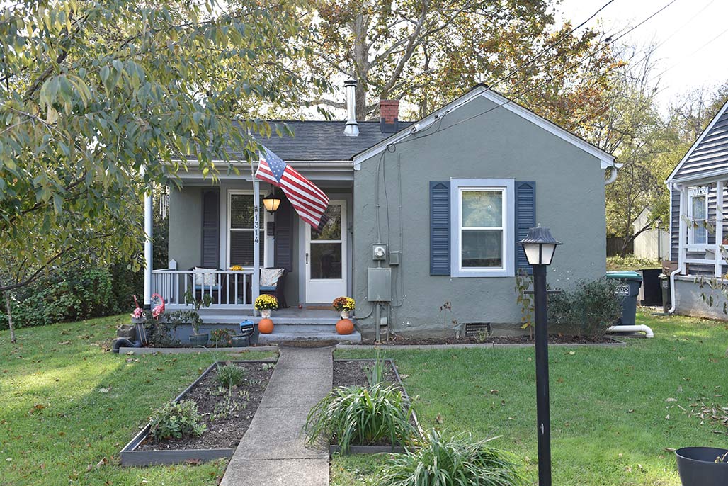
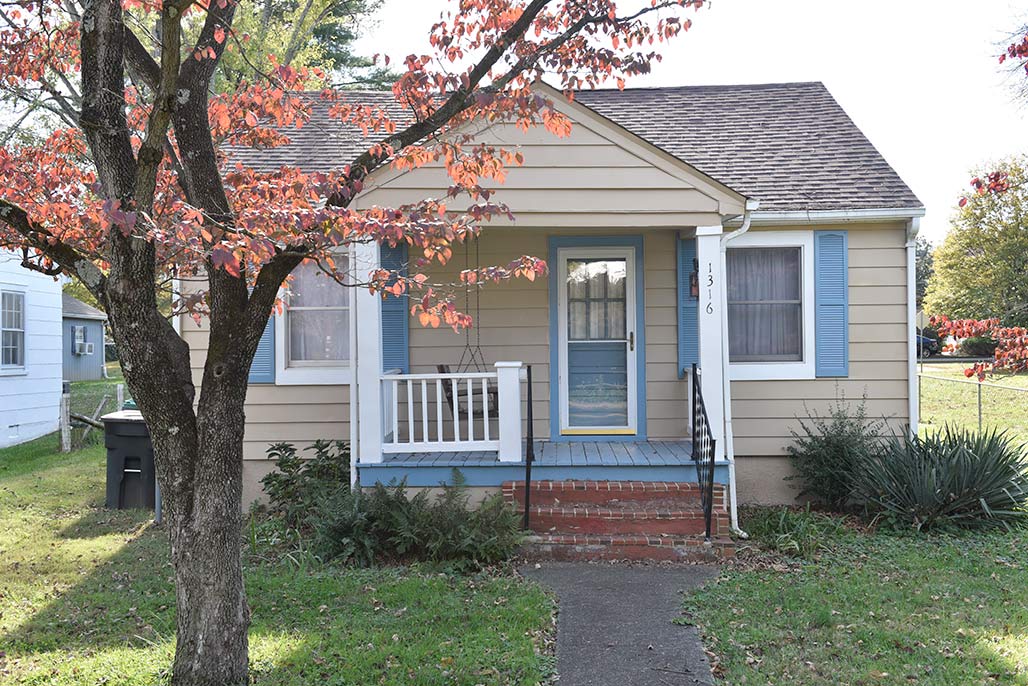
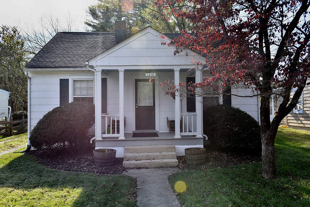
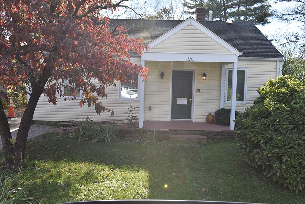
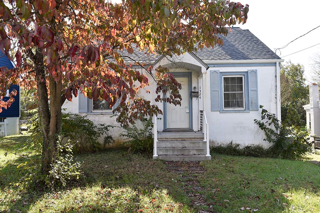
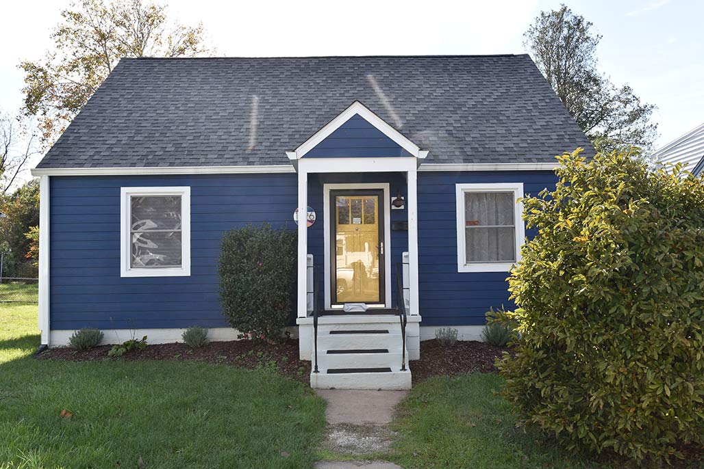
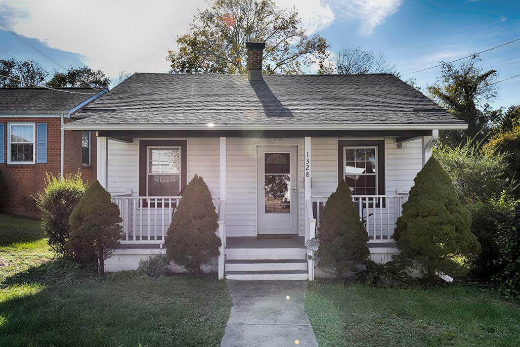
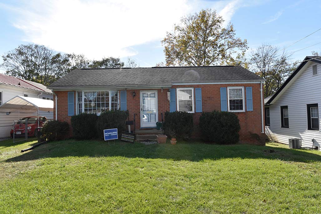
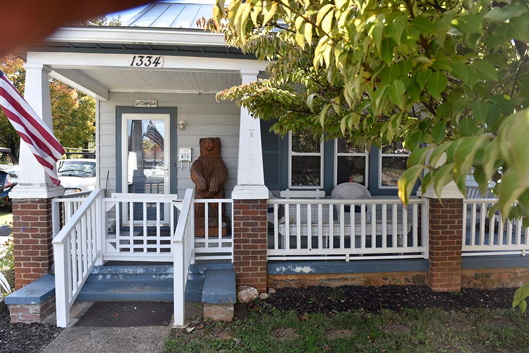
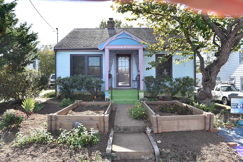
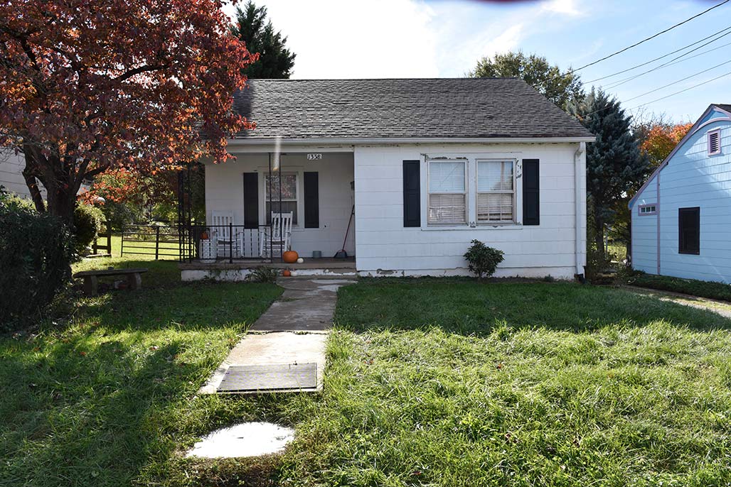
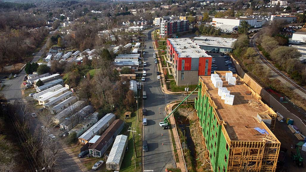
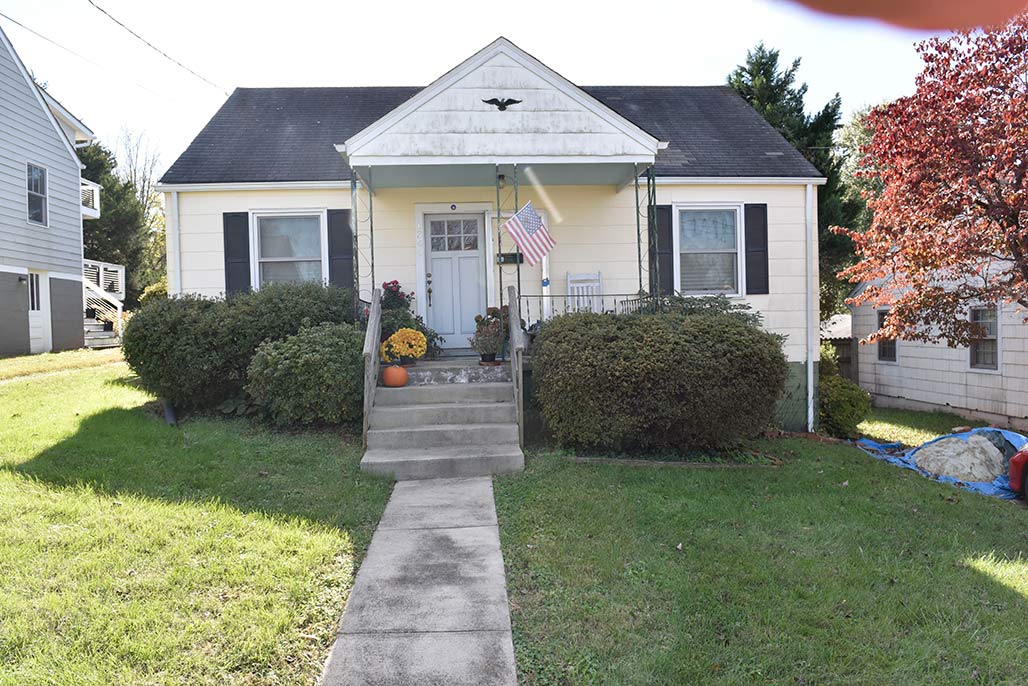
This is a tale about the 22 houses on the left. The 1300 block of Chesapeake Street.


The lots are long and skinny, they are zoned R1s, they are intended for residential use.


The crow’s eye view.

1300 Chesapeake

The houses’ average age is 75 years old, half of them were built by the end of World War II, the other half were finished at the end of the Korean War.

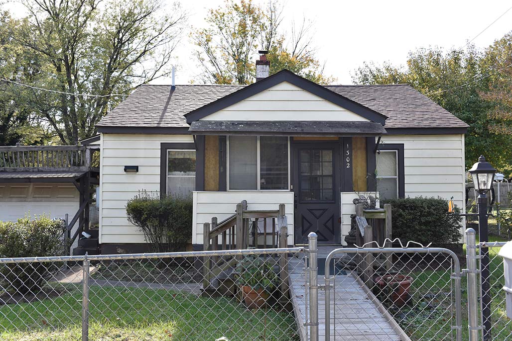
1302 Chesapeake Street

The homes were built by blue-collar people.

1304 Chesapeake

To this day, not one of them features a garage or a swimming pool.

1306 Chesapeake

Nine of the houses are rented, thirteen are owner occupied

1308 Chesapeake

The houses don’t tend to flip, the average last date of sale was twenty-two years ago.

1310 Chesapeake

Over the years I’ve made the acquaintance of a handful of the residents while walking by.

1314 Chesapeake

I’ve met a librarian, a plumber, a teacher, a postal worker, a United States Marine

1316 Chesapeake

a boat captain, students, an X-ray tech, a museum worker and an IT person.

1318 Chesapeake

These houses average 1100 square feet finished living area.

1320 Chesapeake

The average lot the houses sit on is 0.18 acres, that is five dwelling units per acre (DUA).

1322 Chesapeake

Their average assessment is 290 thousand dollars.

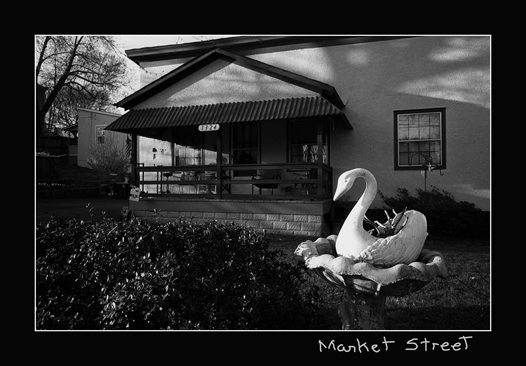
1324 Chesapeake

The 22 homes, are stable, they are occupied, they are the refuge of families who moved to the neighborhood and planned to stay.

1326 Chesapeake

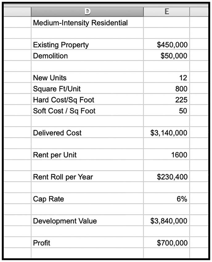
I believe that painting this block with a medium intensity residential (MIR) land use designation is not acceptable planning.

1328 Chesapeake

The MIR designation is unfair to the residents

1330 Chesapeake

The designation will target their houses for demolition, it is an economic bulldozer.

analysis

.

1332 Chesapeake

The Woolen Mills neighborhood requested a small area plan from the City in 1988.

1334 Chesapeake

If the City had provided a framework for public and private investment decisions to the Woolen Mills by means of a small area planning process decades ago the current action could make sense.

1336 Chesapeake

But there has been no small area plan.

1338 Chesapeake

I encourage Council to get scientific, to use the tools of Archimedes and Galileo, math and maps.
Pick some baselines to trigger small area plans in neighborhoods with significant proposed up-zoning.

1340 Chesapeake

For example, if a rezoning will potentially displace 50% of the area’s existing residents, perform a Small Area Plan.
If a rezoning will increase DUA by more than 10X, perform a Small Area Plan.

1342 Chesapeake

Effective city planning is done by having comprehensive neighborhood plans that share the benefits and burdens required to keep the City humming along in an equitable, healthy fashion.

1344 Chesapeake

The 2021 Comprehensive Plan is intended to guide the coordinated harmonious development of the territory within the City to promote the health, safety, order, convenience, prosperity and general welfare of the city’s inhabitants.

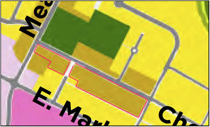
The 22 are in the beige, outlined in red.

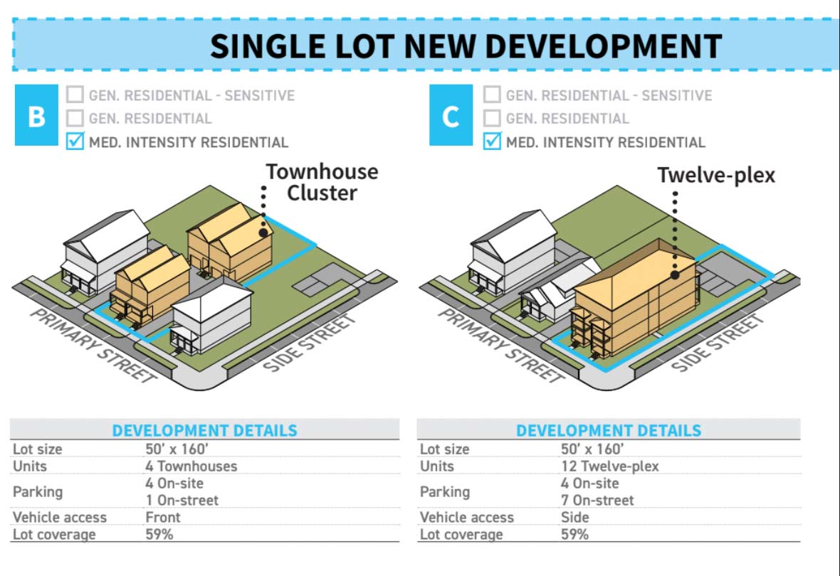
City Council will decide on the fate of these 22 houses in the next few weeks when they vote on the Future Land Use Map, a part of the not yet approved Comprehensive Plan. Currently, the map shows these humble houses being “redesignated” to a much more intense use known as “medium intensity residential”.

About the medium intensity residential (MIR) the urban planners say:

Medium Intensity Residential: Increase opportunities for housing development including affordable housing, along neighborhoods corridors, near community amenities, employment centers, and in neighborhoods that are traditionally less affordable.

In the case of the 22. These houses, on the spectrum of CHO housing, are affordable. To me, they don’t seem to fit the planners’ criteria. These houses are on a neighborhood street not a “corridor”. The houses aren’t near employment centers.
The MIR designation will potentially result in the demolition of these residences.

What could replace one of these houses once it was demolished? The planners say:

Form + Use:
Allow up to 12 residential units (depending on site characteristics and context, to be further defined in the zoning ordinance; many areas may be limited based on lot size and other factors)

Allow structures up to 4 stories (depending on site characteristics and context, to be further defined in the zoning ordinance; many areas may be limited based on lot size and other factors)

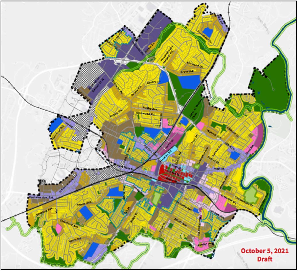
draft Land Use Plan

All the neighborhoods in beige are similarly threatened.

Bye-bye.

(I would encourage all concerned to write to City Councilors and to participate at the Council meeting on this subject November 15, 2021. Details of how to participate are available here) https://cvilleplanstogether.com/

Medium-Intensity Residential: Maximum-Intensity Pain

Medium-Intensity Residential needs to be scaled back in both scope and intensity. It is too much to ask people who bought in R-1 neighborhoods (over 60% of the parcels designated for Medium-Intensity Residential) to accept 12-unit (and possibly larger) buildings and 4+ stories, and it is not necessary for making our housing market more flexible, given other changes under the FLUM. The areas designated – changing up the last minute — do not make sense. MIR areas actually have a lower average Walkscore than General Residential. They lack critical infrastructure and some are so far below required density to support commercial amenities that their ultimate arrival is highly uncertain. There is no precedent for buildings above 3.5 stories in most of these areas. High-Intensity residential, on the other hand, shows clear differences — high walkability, transit access, existing infrastructure and height. With MIR, we could end up with a “worst-of-all-worlds” situation of having a scattering of MFH buildings isolated from amenities. And folks living in MIR feel targeted, because there is no compelling explanation of why their blocks should face a much more extreme transformation than nearly identical blocks nearby. If you need the MIR category to exist, scale it back to a few areas already adjacent to amenities, existing density and infrastructure.–CFRP

The Comprehensive Plan can go forward without a finalized land use map. Move head with the CP, move ahead with the many non-map aspects of the Affordable Housing Plan. But the map ought to be done in conjunction with plot-by-plot zoning. This is how planning usually works.–CFRP

land use maps comp plans etc

intersection Franklin and Broadway
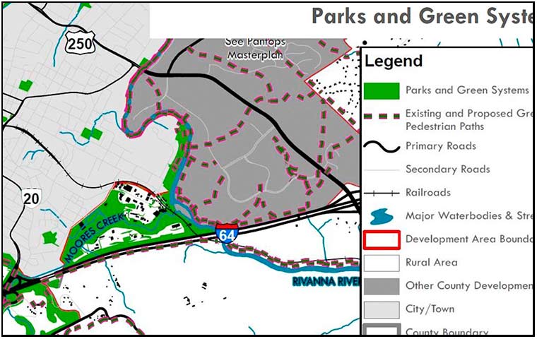
People in the City are nervous about the planning currently going on. What will the plan do to the City? How does the land use map work with zoning? What will it mean? The photo above is Franklin Hill, a forested hillside northwest of Monticello. Once upon a time the site of the Woolen Mills Park. The county land use map addresses this area, no worries! It is shown on the map. Parks and Green systems.
parks and Green systems
Nothing to worry about.

Urban Renewal 2.0

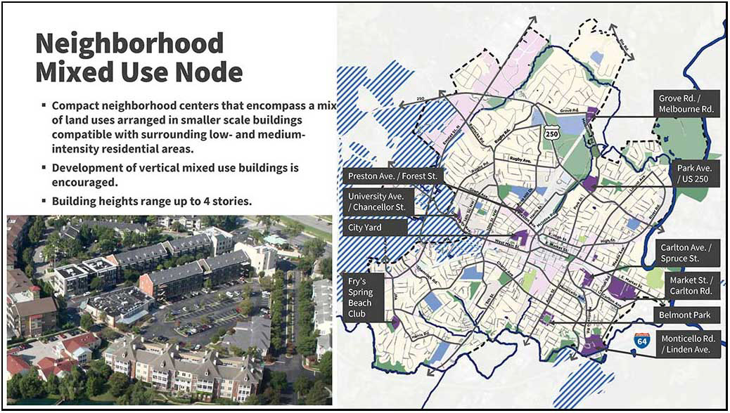
neighborhood mixed use node infographic

page 17 of a slideshow shown at the 3/30/2021 Planning Commission work session. https://boxcast.tv/channel/iweiogrihxlnnvn2sxqx

From the fog of COVID, a draft land use map has emerged. The planning document looks to be a blue print for urban renewal and the starting gun for the teardown of affordable housing in the Woolen Mills Neighborhood.
detail from draft land use map

mixed use node characteristics

The above map is a detail from the draft Land Use Map which was discussed at the Charlottesville Planning Commission’s 3/30/2021 work session. Of particular interest, the purple “Neighborhood Mixed use node” placed on the Woolen Mills neighborhood. At 40 acres, this is the largest such node proposed in the City.

Dorothy Herring Deane used to live here

.

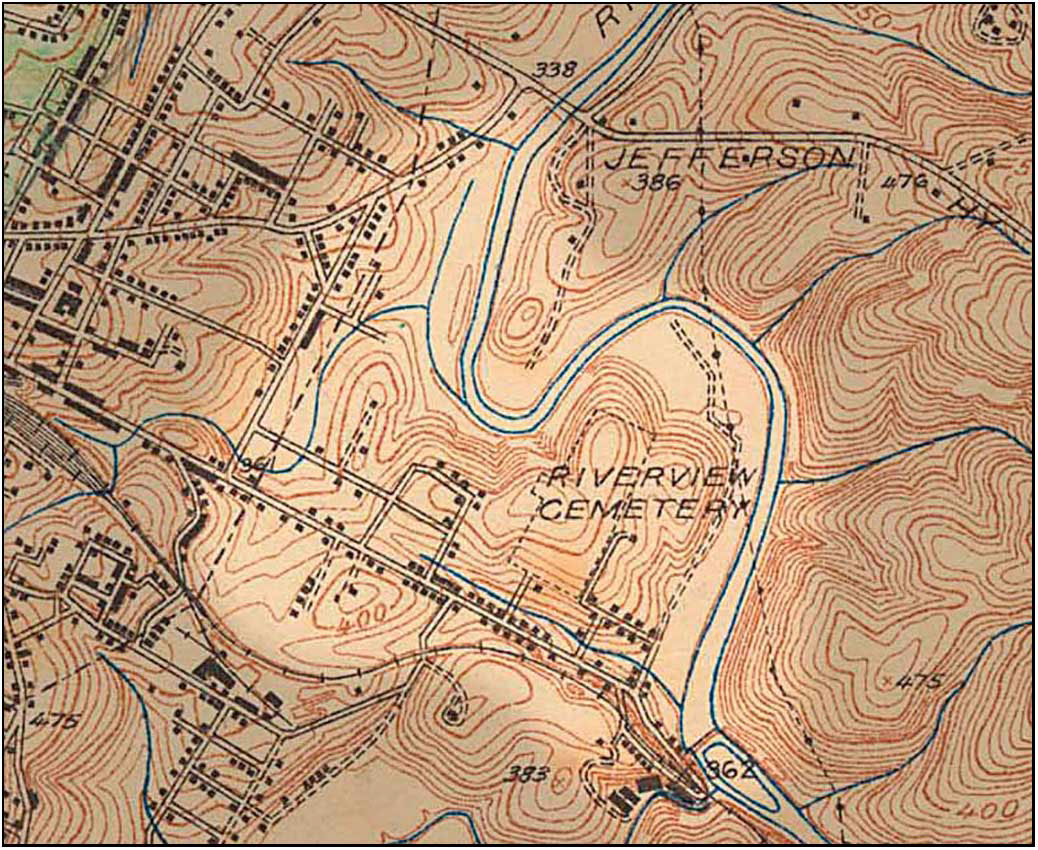
People have lived in houses lining the south edge of Market Street between Meade Avenue and Franklin Street for 135 years. You do not know their names. They are not rich or famous. They call this area their home.

1935 topo map

detail from 1935 topo map. In 1935, 19 houses lined the southern edge of Market Street between Meade and Franklin

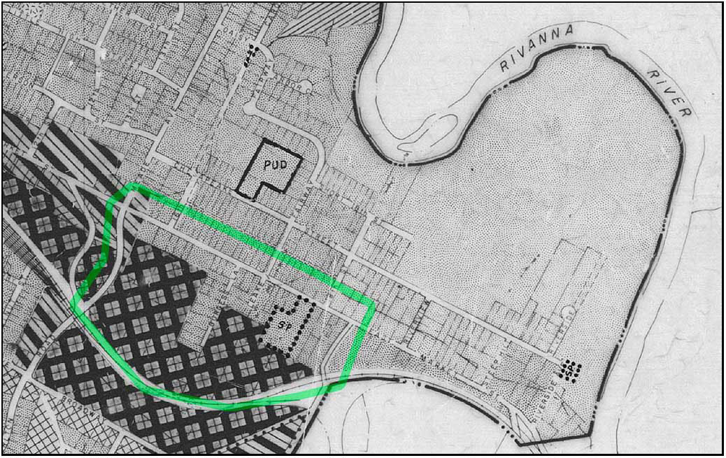
Since its first comprehensive Plan in 1958 the City has represented the bifurcated planning laid across the backyards of these Market Street residential properties in a series of zoning and land use maps.
For 60 years these maps have recognized two elements. The maps show proposed manufacturing, industry, and business in the southern 70% of the land and residential uses bordering Market Street and Franklin.

1976 zoning map detail

1976 zoning map detail

This bifurcated zoning/land use was placed in the backyards of houses and residential properties fronting on the southern edge of Market Street. This allows manufacturing-industrial-business adjacency to residential use, cheek to jowl.

Land Use Plan detail, 8/13/2013

Land Use Plan detail, 8/13/2013

The Woolen Mills Neighborhood has appealed for thoughtful, community-based study and correction of this poorly thought out land use/zoning layout for decades. The Woolen Mills first formal request for a small area plan was made of the City Council at their August 1, 1988 meeting.

In 2013 the Woolen Mills Small Area Plan request had risen to the top of the SAP list, but was bypassed for more exigent planning challenges (Route 29 North, Starr Hill and Cherry Avenue).

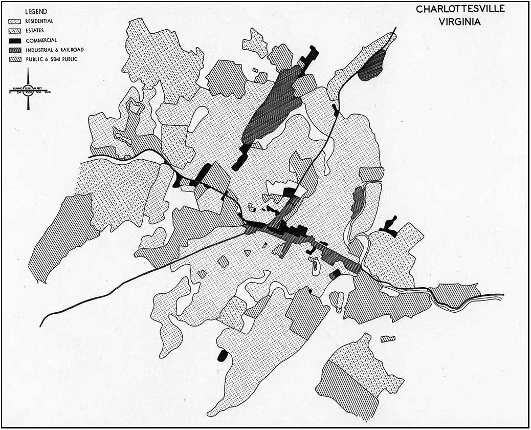
Future Diagrammatic Land Use Map

Future Diagrammatic Land Use Map-1956 HBA

The “new” draft Land Use Map mimics the “Future Diagrammatic Land Use Map” produced by Harland Bartholomew and Associates for the City of Charlottesville in October 1956 in regards to its blanket treatment of the residential community south of Market between Meade Avenue and Franklin Street.
(HBA were the primary architects of “urban removal” in the United States back when neighborhoods were torn down with bulldozers.)

Hoping against hope that the powers that be will rethink the proposed upzoning and destruction of the residential neighborhood fronting on the southern edge of Market Street.
We live here. Please…

houses in question on the right

The area of concern outlined in green.


City Planning Commission member Sue Lewis advised residents from the Woolen Mills neighborhood that “you should have mobilized sooner. When you are living in the middle of a potentially unwanted development, you should act before something happens.”—7/14/1988 Planners approve warehouses in Woolen Mills district by Kay Peaslee Observer staff writer

2002 Land Use Plan petition


I think this issue about, you probably can go all throughout the City and find properties that are, inconsistencies between the land use and comprehensive plan and I think it behooves citizens to be
alert to every single one of those fragments that are left in the City. And I think we are working overtime to try and identify them all and I think it is grossly unfair that everyone should anticipate these areas that are caught in between.

I believe though that the Woolen Mills Neighborhood has not had the benefit of a real plan for how these acres and acres of M1 and B3 uses are going to be developed over ten or twenty years and other neighborhoods have had the benefit of that and it’s made a significant difference in how land will develop.

I know Ridge Street neighborhood had a neighborhood plan done for it, for properties that were zoned what we thought was inappropriate for the neighborhood. That project looked at it through another lens, it recommended down-zoning, it recommended a different kind of housing, and seven years later, the kind of housing that the City had anticipated was done because we dared imagine what a different and better use would be for those properties.

I think it is long overdue for the Woolen Mills that they have a clear signal of where their neighbor-hood is going, and not be done in this piecemeal fashion.
So I guess my hope would be that out of this process, given the talent that they have in their neigh-borhood, that they get together and decide that proactively we are going to tell you what the future of our neighborhood is going to be, and it is not going to continue to be an erosion of the things that they have come to feel anchor their neighborhood, that’s the residential use and some of the mixed use strategies that they have.
So that is one thing I would hope would come out of this process, and I guess you’ll have to wait to hear the outcome, for another two weeks.— Maurice Cox, April 7, 2003

Paul Goodloe McIntire’s Rivanna (10)

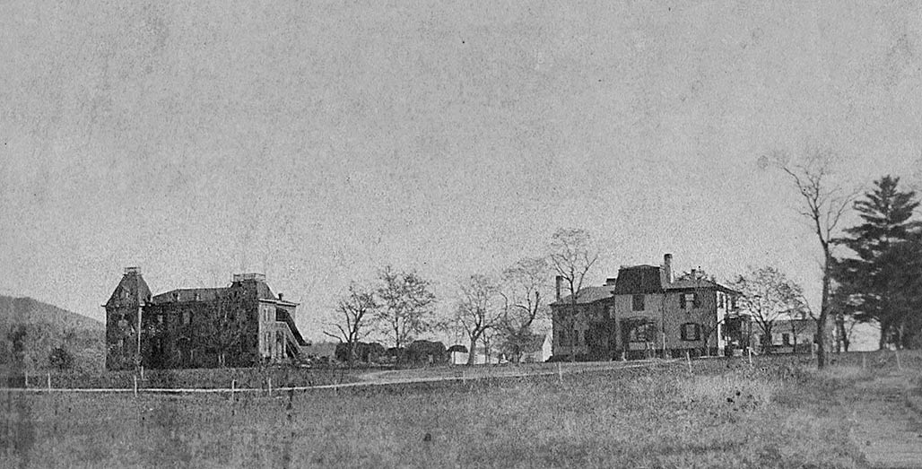
At Pantops, Mcintire was attentive to the vestiges of a prior institutional landscape and a set of buildings that could be adapted for the treatment of patients with mental illness. In 1877, Reverend Edgar Woods had purchased 373 acres at Pantops and opened Pantops Academy, a boys’ preparatory school, with close connections to the University of Virginia.

Pantops Academy

UVA Special Collections Pantops Academy

The Academy promoted the healthy, uplifting, character of the site–a setting and a rhetoric that could have easily been adapted from education to healing patients. In 1894, the Academy catalog declared, “The place formerly belonged to Thomas Jefferson, and is on the hill opposite his home, MONTICELLO. Its name was given by him for two Greek words, meaning ‘All seeing,’ in allusion to the prospect, which embraces the town of Charlottesville, the University of Virginia and a wide extent of plain and mountain scenery, not excelled by any other portion of the land. The surrounding region is one of the most healthy which the country contains, and is absolutely free from every kind of malaria …. It is scarcely possible to emphasize too much the unsurpassed location of the Academy, which not only delights the eye with the wide range and beauty of the landscape, but which ensures the best sanitary conditions, through perfect drainage and purest mountain air. Its distance from Charlottesville secures it from town temptations.” The Pantops Academy drew much of its food from its own farmlands declaring, “The teachers and pupils live together as one large family. The table is largely supplied from the farm, thus commanding abundance of milk and cream from its own dairy, fresh vegetables and fruit from its own garden and orchard and its fresh meat from its own flocks.”

Pantops Academy

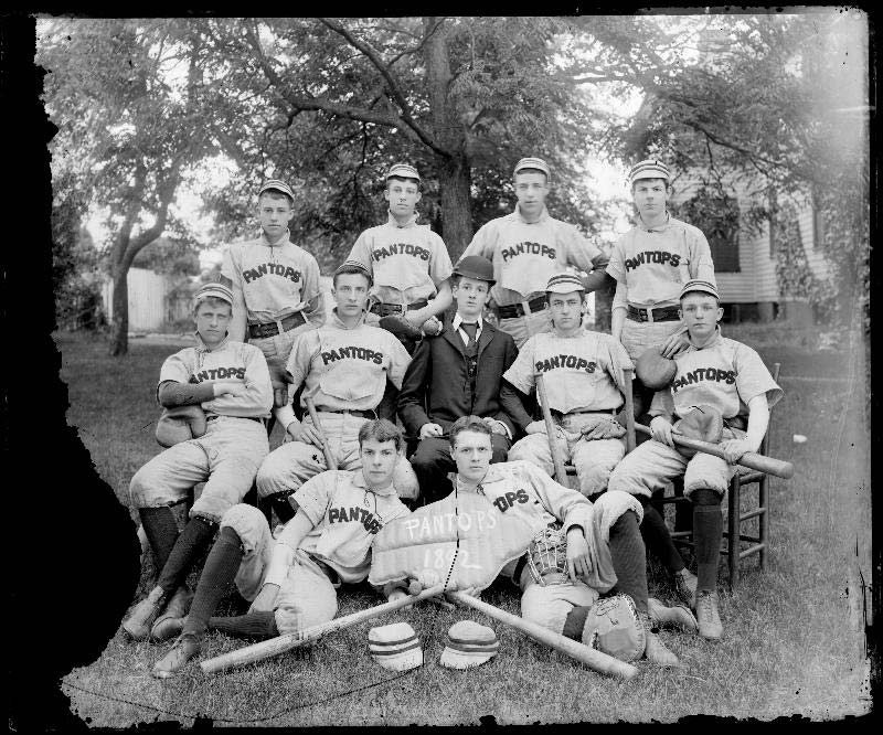
Baseball team, Pantops Academy, 1892. University of Virginia, Holsinger Studio Collection

The Academy provided an indoor gymnasium but insisted that the site itself, with its elevated views, its hills, pastures, gardens, and river would provide for the healthy “physical culture” of the students with the “large grounds and the ample range the country thus affords.” Even though the Academy had closed in 1904, the prominent dorm and classroom building, built in 1884, and the rambling principal’s residence still dominated the site. Mcintire could imagine that they would be easily adapted for a psychiatric treatment hospital. Essentially what Mcintire could see in Pantops was what he had seen in the possibilities of a Rivanna public park–a landscape that would provide comfort and engagement and continue to cultivate the vital historical relationship between people in the region and their river.

Rivanna

Rivanna at Riverview Park. Montalto in the distance.

It was only a matter of months between Mclntire’s Pantops purchase in July 1929 and the crash of the stock market. In the midst of the Depression, the University was not able to expand to Pantops, and in 1937 the University’s Board of Visitors resolved to sell Pantops to James H. Cheek for use as a private country estate and horse farm. The proceeds of the sale were devoted to the development of psychiatry at the University hospital. In the late twentieth and early twenty-first century, Pantops was divided for private residential and commercial developments. State Farm Insurance opened a regional headquarters on part of the land in 1979. The Pantops Shopping Center opened in 1984. The Westminster Canterbury Retirement Community opened in 1990 and the new Martha Jefferson Hospital moved to Pantops in 2011. By 2010, Free Bridge carried an average of 38,000 cars a day over the Rivanna between Pantops and Charlottesville; however, the automotive landscape that gripped the river and determined adjacent lands uses did little to connect people to this particular and special place or to the Rivanna itself, with its rich historical, cultural, and environmental resources.

Pantops sidewalk

Sidewalk to the summit.

Mclntire’s vision for the Rivanna embodied a complex ideal concerning the proper relationship between the Rivanna, the broader development of the city, and the citizens of Charlottesville. Interestingly, the person who enacted part of this vision in the wake of Mclntire’s failure was John Wesley Bagby (1888-1968), a life-long employee of the Charlottesville Woolen Mill, who labored initially as a mill hand and became the superintendent of the dye works. In 1928, Bagby purchased 23 acres of the Albemarle Golf Club lands along the Rivanna for $3,000. Around 1940, Bagby began using his land as a site for periodic circuses and carnivals. This tradition lasted for half a century. When the three-ring Barnum and Bailey circus visited in 1954, the enormous circus tent pitched on the banks of the Rivanna, just south of Free Bridge, would accommodate 10,000 spectators who came to see elephants, tigers, clowns, and high-wire gymnasts perform. Here was a vision of a city gathering along the river for amusement, entertainment, relaxation, and neighborly socializing. But even these events only took place periodically.

Circus grounds

Bagby’s Circus Grounds 2014

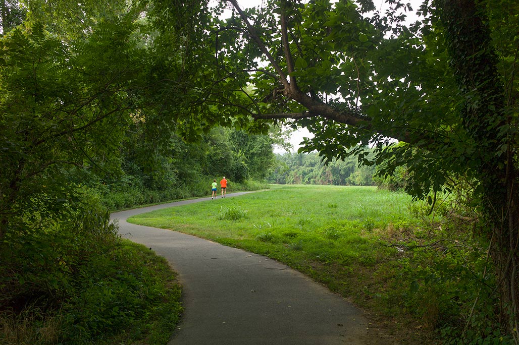
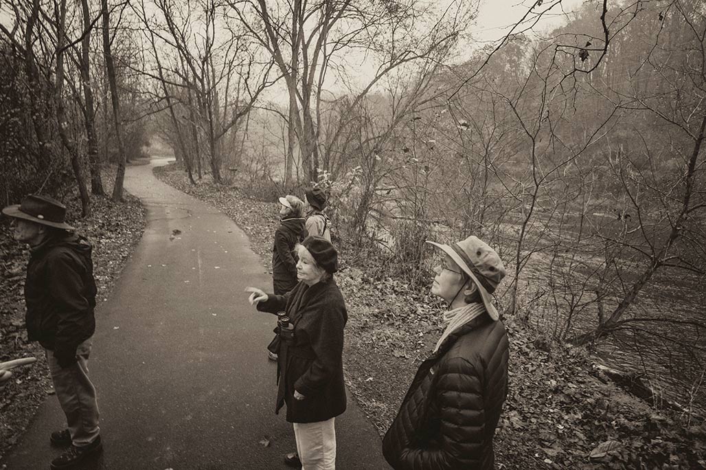
The rising national environmental movement began to frame local connections to the Rivanna from the 1960s onward. The Virginia Assembly passed the Scenic River Act in 1970; the Act required that scenic values be considered in public planning decisions around designated scenic rivers and established regulations to prevent the construction of dams that impeded the flow of water on scenic rivers. The section of the Rivanna River in Fluvanna County was designated in 1974, and the designation was moved upstream to the dam at the Charlottesville Woolen Mills in the late 1980s and to the South Fork Reservoir Dam in 2009; this later designation was granted after the Woolen Mills Dam was removed in 2007 to promote the ecological health of the river and its fish population. The opening of a jointly purchased city-county park in 1986, now named Darden Towe Park, prompted a series of initiatives in the 1980s and 1990s to open trails along the Rivanna with legal easements over privately held property. The trails now amount to ribbon parks and are popular for outdoor exercise, walking, running, and biking.

Birders

Birders

The environmental focus on the Rivanna River is a much narrower vision than Paul Goodloe Mcintire had tried to effect. When Charles Hurt filed plans for the Pantops Shopping Center in the 1980s, people advocating for the Rivanna’s ecology opposed the plan, worrying about pollution, run-off, and flooding. The Rivanna represented a problem and a threat for the Pantops Shopping Center development. The Center ended up being constructed with its back to the Rivanna, largely disengaged from the river.
Mclntire’s failed 1920s plans for connecting the city and the Rivanna represented a more complex integrated vision that reflected the historical realities of the river’s significant place in the region. The vision saw people living, working, recreating, and being healed in a landscape that intermingled human artifice with a key environmental and cultural system-the Rivanna River. In the early twentieth-first century, the Rivanna is part of many people’s lives in the region. When they turn on the tap in their sinks, water arrives from the South Fork of the Rivanna River. When their streets and houses shed rainwater, or when they flush their toilet, they send away liquid waste that eventually ends up in the Rivanna. And yet relatively few people really experience, know, or understand the Rivanna River. The rise of the single purpose planning, for recreation, water supply, sewage disposal, transportation, and housing has exacerbated this reality. When Mclntire’s vision for the Rivanna failed, many citizens in Charlottesville lost sight of their history and their river.

Rivanna

The Rivanna behind Riverbend Shopping Center

Paul Goodloe McIntire’s Rivanna: The Unexecuted Plans For a River City is by Daniel Bluestone and Steven G. Meeks. This article was published in Volume 70 2012 of the Magazine of Albemarle County History by the Albemarle Charlottesville Historical Society. Copies of the Magazine are available at www.albemarlehistory.org