Randy Scruggs

1609 E Market

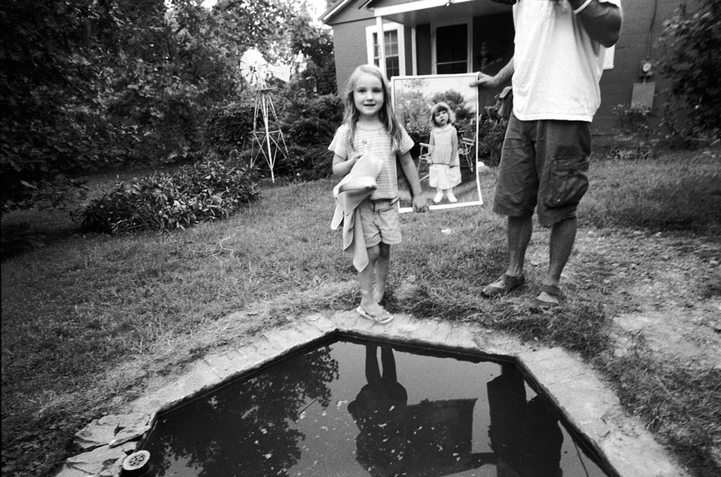
Betty Lou and Randy

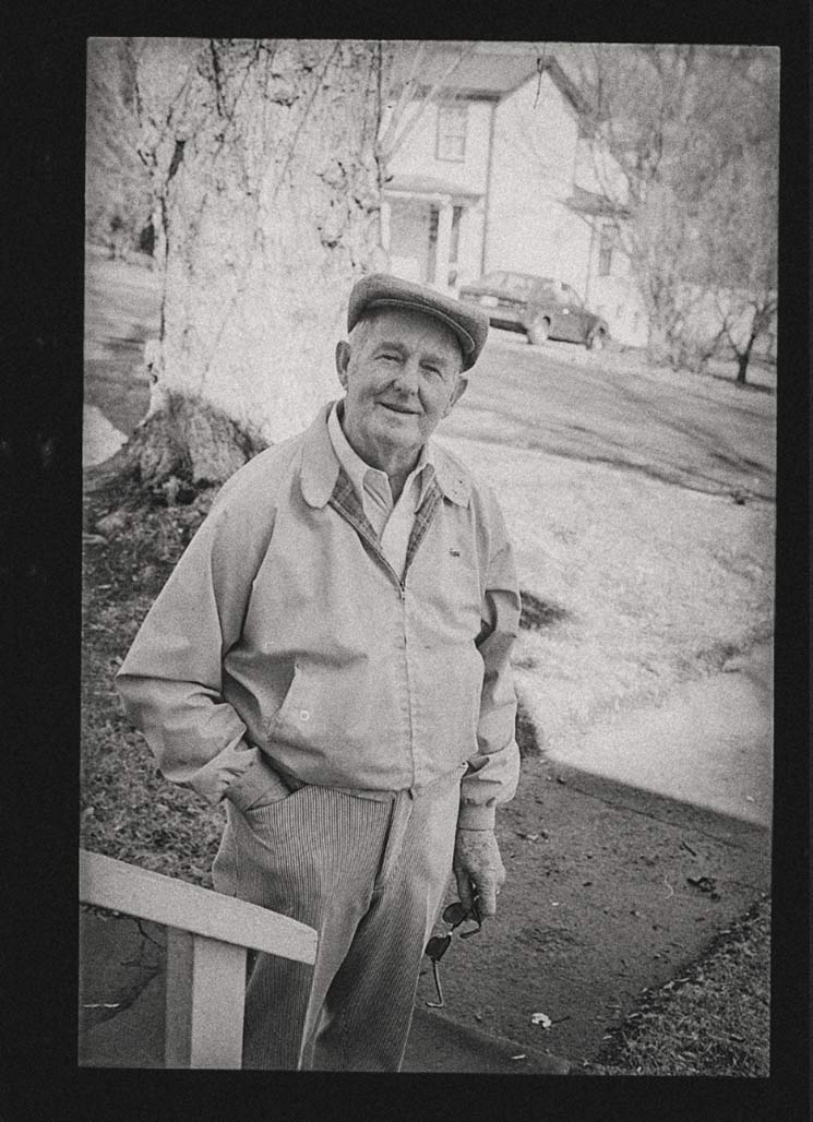
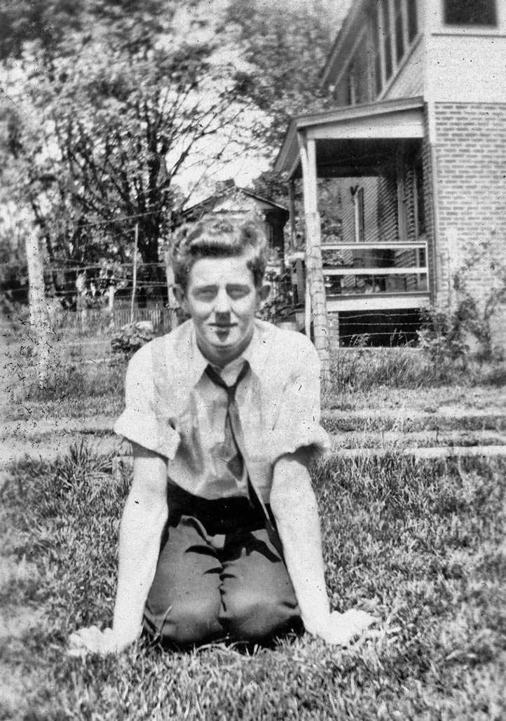
Lucian Randolph “Randy” Scruggs was born on October 6, 1936, to Lucian Scruggs Sr. and Virginia Hall Scruggs. He died on March 2, 2023.
Survivors include the love of his life, Judy Lang Scruggs; a daughter, Dr. Katherine Scruggs and her husband, Pete Smith, of Pittsburgh, Pa.; a granddaughter, Kristina Scruggs of Va. Beach, Va.; two grandsons, Patrick Scruggs and his wife, Nicole, of Richmond, Va., and Wyatt Smith of Pittsburgh, Pa.; a sister-in-law, Peggy Howdyshell and her husband, Dr. Larry Howdyshell, of Roanoke, Va., and Vicki Miller and her husband, Brian, of Charlottesville, Va., as well as a number of cousins, nieces and nephews. Randy was predeceased by his parents, Lucian and Virginia Scruggs; a sister, Betty Lou Scruggs; and a son, Rick Scruggs.
Randy lived in Charlottesville all his life where he attended McIntire School. He served in the Air Force in Korea. After his service in Korea, he worked for the U.S. Postal service for 33 years. After retiring from the Post Office, he worked at both Teague and Hill and Wood Funeral Homes. He attended University Baptist for a number of years, and belonged to Aldersgate United Methodist Church. He was a lifetime member of Elks Lodge # 389, and also belonged to the American Legion Post # 74 for over 30 years.
In his younger years, Randy was a master gardener, his gardens being the envy of the Woolen Mills Neighborhood. He enjoyed reading western novels, listening to country music and watching sports, especially the UVA Women’s Basketball teams.
Randy was generous to a fault. He lived his faith quietly and loved his family dearly and unconditionally.
In lieu of flowers, donations may be made to Aldersgate United Methodist Church, 1500 East Rio Road, Charlottesville, VA 22901 or St. Jude’s Hospital.
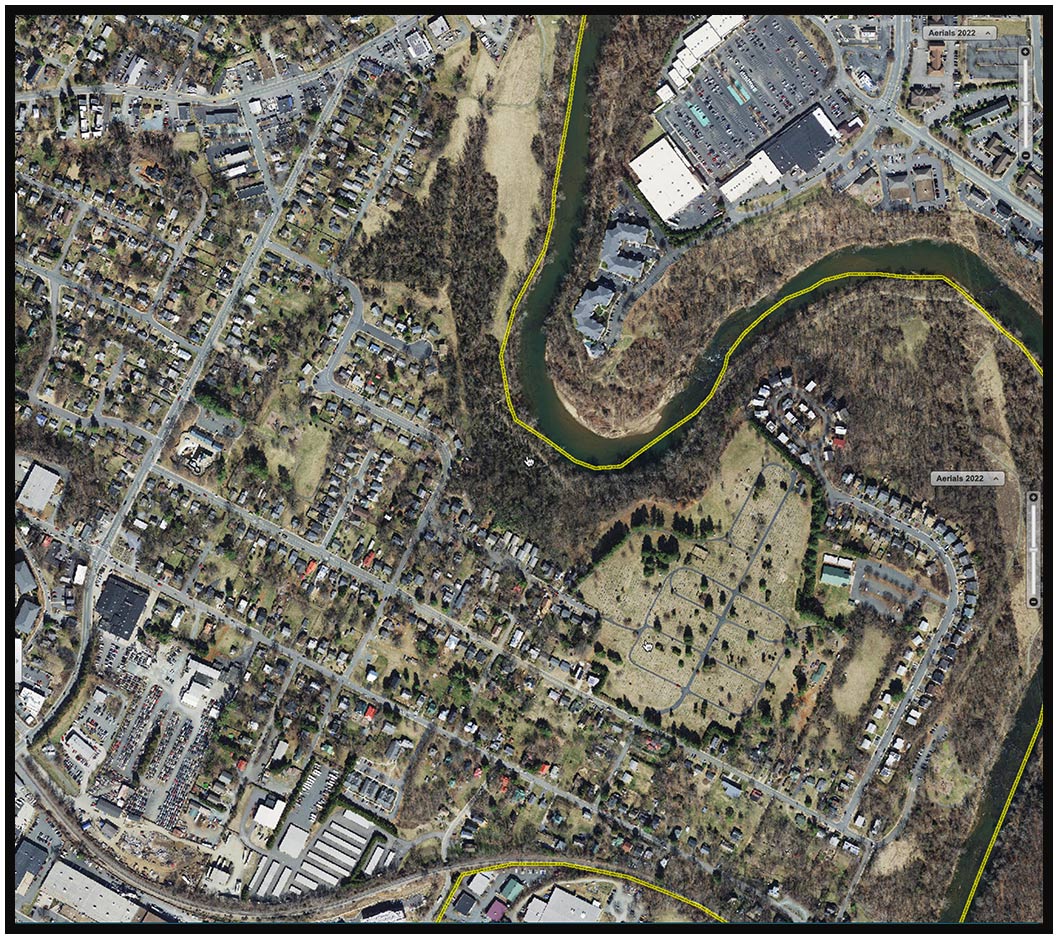
A visitation will be held from 6 until 8p.m. Monday, March 6, 2023, at Hill and Wood Funeral Home, 201 N. 1st St., Charlottesville, Va. Funeral services will be held 2 p.m. Tuesday, March 7, 2023, at Aldersgate United Methodist Church, 1500 East Rio Road, Charlottesville, VA 22901. A graveside service will follow at Riverview Cemetery, 1701 Chesapeake Street, Charlottesville, VA 22902. Condolences may be expressed to the family at hillandwood.com.

Changeless change

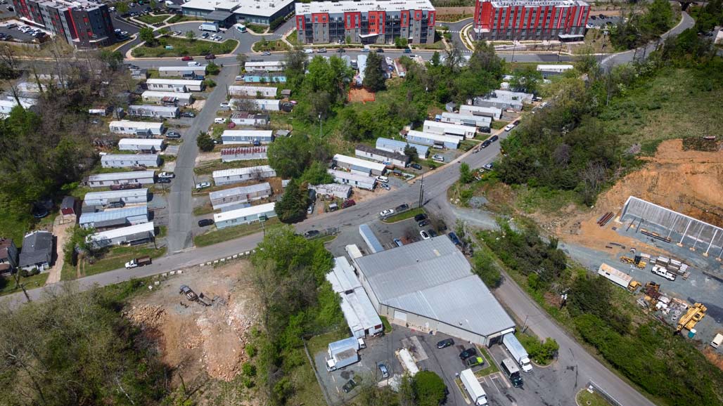
City County boundary

Franklin Street is the City County boundary.

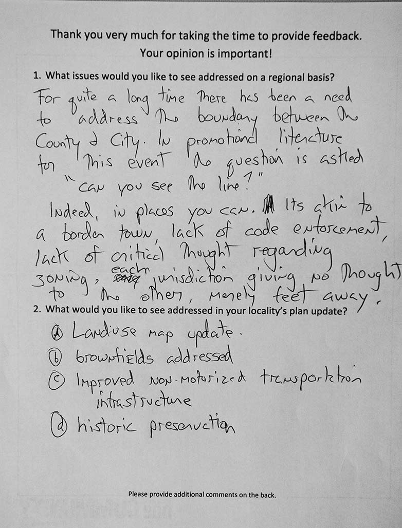
Many plans, one community, an aspirational name for a government program, Charlottesville and Albemarle syncing the development of their Comprehensive Plans. The request for comment form from a meeting in April 2011. Much remains to be fixed.

Free

arbor day free trees

CHARLOTTESVILLE, VA – The Charlottesville Department of Utilities is excited to add the Arbor Day Foundation’s Energy-Saving Trees Program to its lineup of energy conservation initiatives. This partnership provides 200 free trees to Utilities customers within the City of Charlottesville, encouraging them to conserve energy and reduce energy bills through strategic tree planting.
The strategic planting of trees provides a variety of benefits for individual households, as well as the broader community. Properly planted trees can reduce the amount of energy a home requires to remain comfortable by providing a barrier to cold winter winds and delivering shade in the summer. When planted properly, a single tree that grows over time can save a homeowner up to 20% on energy costs. Trees also provide a number of benefits for the entire community, such as increasing capacity for carbon sequestration, improving air quality, and providing more effective stormwater filtration and runoff reduction to help keep pollutants out of water supplies.  

tree

With guidance from the Charlottesville Tree Commission, available tree varieties include Southern Red Oak, Serviceberry, Sycamore, Willow Oak, and Black Gum. Tree reservations are limited to one tree per service address and made on a first-come, first-served basis beginning Monday, March 14th. Reservations can be accessed through Utilities’ interactive tree portal provided by the Arbor Day foundation at www.arborday.org/charlottesville. This user-friendly portal provides simple step-by-step instructions that focus on homeowner education, and maximizing environmental impact, to calculate where to specifically and strategically plant trees for the greatest energy- and money-saving benefit.
Safety is essential to a successful landscaping project, and this program serves as a great opportunity to reinforce safe digging practices with the community – especially with the outdoor project season almost here. Prior to planting a tree, customers are expected to follow the law, and contact Virginia 811 at least three working days before planting to have the location of buried utility lines on their property marked by a professional. Knowing the location of buried utilities helps prevent their damage, and a potentially hazardous situation. The service is free, and allows customers to dig safely while planting their tree.

For more information about the Energy-Saving Trees Program and the Arbor Day Foundation contact Utilities Outreach at utilitiesoutreach@charlottesville.gov.  

bye bye


This is a tale about the 22 houses on the left. The 1300 block of Chesapeake Street.


The lots are long and skinny, they are zoned R1s, they are intended for residential use.


The crow’s eye view.

1300 Chesapeake

The houses’ average age is 75 years old, half of them were built by the end of World War II, the other half were finished at the end of the Korean War.

1302 Chesapeake Street

The homes were built by blue-collar people.

1304 Chesapeake

To this day, not one of them features a garage or a swimming pool.

1306 Chesapeake

Nine of the houses are rented, thirteen are owner occupied

1308 Chesapeake

The houses don’t tend to flip, the average last date of sale was twenty-two years ago.

1310 Chesapeake

Over the years I’ve made the acquaintance of a handful of the residents while walking by.

1314 Chesapeake

I’ve met a librarian, a plumber, a teacher, a postal worker, a United States Marine

1316 Chesapeake

a boat captain, students, an X-ray tech, a museum worker and an IT person.

1318 Chesapeake

These houses average 1100 square feet finished living area.

1320 Chesapeake

The average lot the houses sit on is 0.18 acres, that is five dwelling units per acre (DUA).

1322 Chesapeake

Their average assessment is 290 thousand dollars.

1324 Chesapeake

The 22 homes, are stable, they are occupied, they are the refuge of families who moved to the neighborhood and planned to stay.

1326 Chesapeake

I believe that painting this block with a medium intensity residential (MIR) land use designation is not acceptable planning.

1328 Chesapeake

The MIR designation is unfair to the residents

1330 Chesapeake

The designation will target their houses for demolition, it is an economic bulldozer.

analysis

.

1332 Chesapeake

The Woolen Mills neighborhood requested a small area plan from the City in 1988.

1334 Chesapeake

If the City had provided a framework for public and private investment decisions to the Woolen Mills by means of a small area planning process decades ago the current action could make sense.

1336 Chesapeake

But there has been no small area plan.

1338 Chesapeake

I encourage Council to get scientific, to use the tools of Archimedes and Galileo, math and maps.
Pick some baselines to trigger small area plans in neighborhoods with significant proposed up-zoning.

1340 Chesapeake

For example, if a rezoning will potentially displace 50% of the area’s existing residents, perform a Small Area Plan.
If a rezoning will increase DUA by more than 10X, perform a Small Area Plan.

1342 Chesapeake

Effective city planning is done by having comprehensive neighborhood plans that share the benefits and burdens required to keep the City humming along in an equitable, healthy fashion.

1344 Chesapeake

The 2021 Comprehensive Plan is intended to guide the coordinated harmonious development of the territory within the City to promote the health, safety, order, convenience, prosperity and general welfare of the city’s inhabitants.

The 22 are in the beige, outlined in red.

City Council will decide on the fate of these 22 houses in the next few weeks when they vote on the Future Land Use Map, a part of the not yet approved Comprehensive Plan. Currently, the map shows these humble houses being “redesignated” to a much more intense use known as “medium intensity residential”.

About the medium intensity residential (MIR) the urban planners say:

Medium Intensity Residential: Increase opportunities for housing development including affordable housing, along neighborhoods corridors, near community amenities, employment centers, and in neighborhoods that are traditionally less affordable.

In the case of the 22. These houses, on the spectrum of CHO housing, are affordable. To me, they don’t seem to fit the planners’ criteria. These houses are on a neighborhood street not a “corridor”. The houses aren’t near employment centers.
The MIR designation will potentially result in the demolition of these residences.

What could replace one of these houses once it was demolished? The planners say:

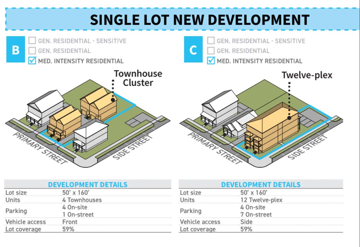
Form + Use:
Allow up to 12 residential units (depending on site characteristics and context, to be further defined in the zoning ordinance; many areas may be limited based on lot size and other factors)

Allow structures up to 4 stories (depending on site characteristics and context, to be further defined in the zoning ordinance; many areas may be limited based on lot size and other factors)

draft Land Use Plan

All the neighborhoods in beige are similarly threatened.

Bye-bye.

(I would encourage all concerned to write to City Councilors and to participate at the Council meeting on this subject November 15, 2021. Details of how to participate are available here) https://cvilleplanstogether.com/

Medium-Intensity Residential: Maximum-Intensity Pain

Medium-Intensity Residential needs to be scaled back in both scope and intensity. It is too much to ask people who bought in R-1 neighborhoods (over 60% of the parcels designated for Medium-Intensity Residential) to accept 12-unit (and possibly larger) buildings and 4+ stories, and it is not necessary for making our housing market more flexible, given other changes under the FLUM. The areas designated – changing up the last minute — do not make sense. MIR areas actually have a lower average Walkscore than General Residential. They lack critical infrastructure and some are so far below required density to support commercial amenities that their ultimate arrival is highly uncertain. There is no precedent for buildings above 3.5 stories in most of these areas. High-Intensity residential, on the other hand, shows clear differences — high walkability, transit access, existing infrastructure and height. With MIR, we could end up with a “worst-of-all-worlds” situation of having a scattering of MFH buildings isolated from amenities. And folks living in MIR feel targeted, because there is no compelling explanation of why their blocks should face a much more extreme transformation than nearly identical blocks nearby. If you need the MIR category to exist, scale it back to a few areas already adjacent to amenities, existing density and infrastructure.–CFRP

The Comprehensive Plan can go forward without a finalized land use map. Move head with the CP, move ahead with the many non-map aspects of the Affordable Housing Plan. But the map ought to be done in conjunction with plot-by-plot zoning. This is how planning usually works.–CFRP

Sean Tubbs reports

Wednesday June 2 the Albemarle Board of Supervisors will receive an update on a project to extend the Old Mills Trail along the Rivanna River. “Implementation of the Old Mills Trail Extension between Pantops and Milton will require the acquisition of easements across multiple properties,” reads the report. “This easement acquisition process is partially complete. The remaining properties where greenway easements must be obtained are now all owned by the Thomas Jefferson Foundation (Monticello) following their recent acquisition of the last remaining privately-owned riverfront parcel in this planned greenway corridor.” 

The above from local independent journalist reporter Sean Tubbs. Sean thoroughly covers local events. Subscribe and support his efforts!

land use maps comp plans etc

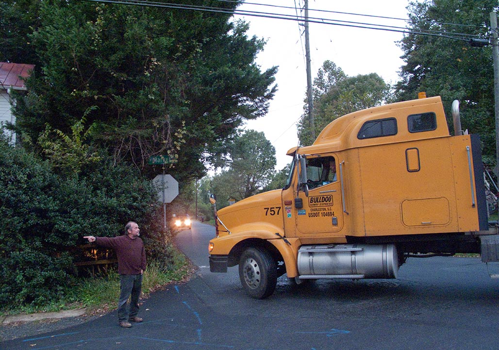
intersection Franklin and Broadway
People in the City are nervous about the planning currently going on. What will the plan do to the City? How does the land use map work with zoning? What will it mean? The photo above is Franklin Hill, a forested hillside northwest of Monticello. Once upon a time the site of the Woolen Mills Park. The county land use map addresses this area, no worries! It is shown on the map. Parks and Green systems.
parks and Green systems
Nothing to worry about.